
Fasciculus:Antikes Alexandria Karte.JPG
Mensura huius perspectionis: 773 × 600 elementa imaginalia. Aliae mensurae: 310 × 240 elementa imaginalia | 619 × 480 elementa imaginalia | 990 × 768 elementa imaginalia | 1 280 × 993 elementa imaginalia | 1 694 × 1 314 elementa imaginalia.
Sua resolutio (1 694 × 1 314 elementa imaginalia, magnitudo fasciculi: 611 chiliocteti, typus MIME: image/jpeg)
| Descriptio |
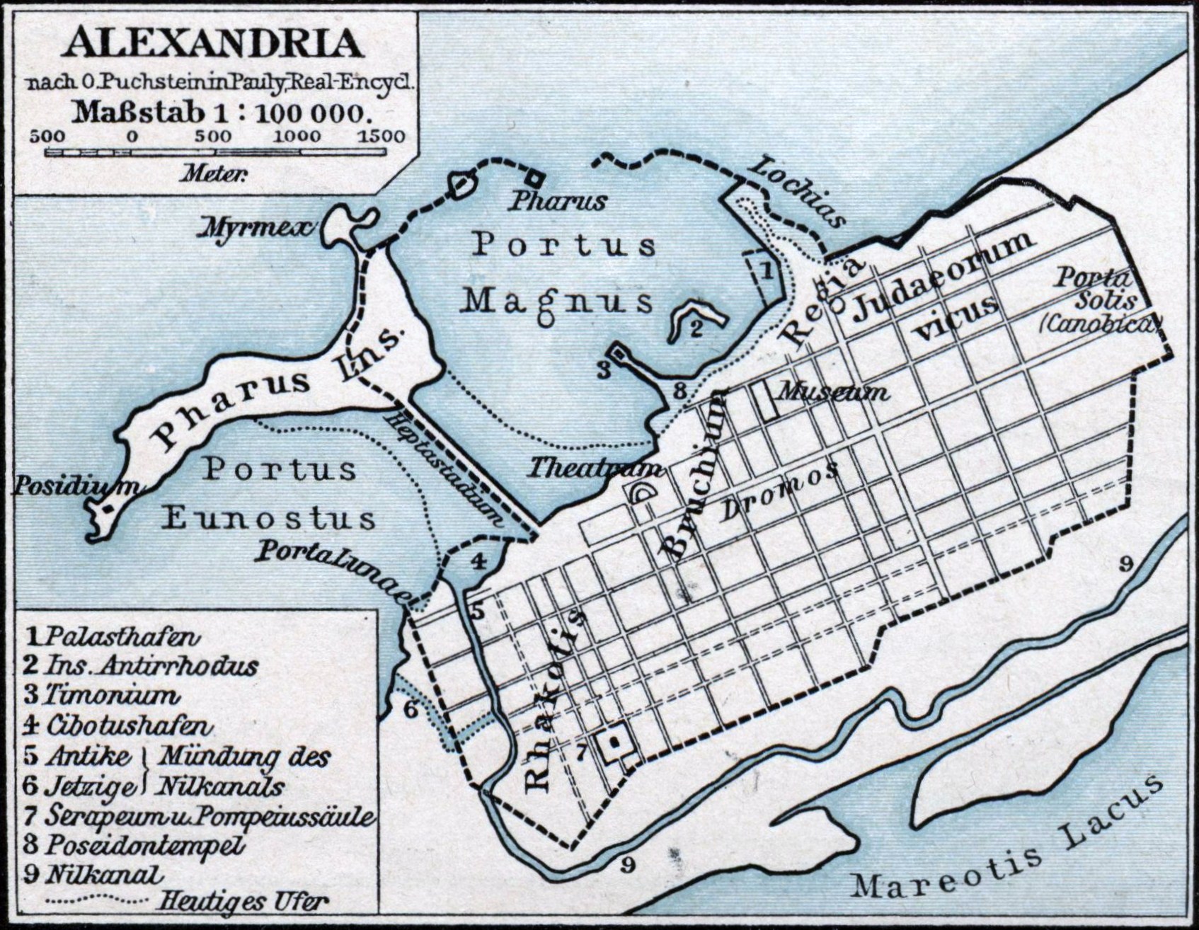
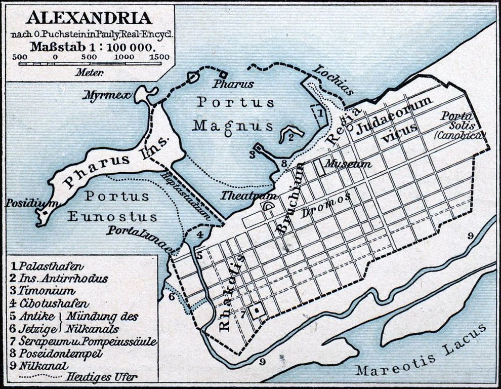
Deutsch: Karte der antiken ägyptischen Stadt Alexandria. |
||||
| Datum | |||||
| Fons | F. W. Putzgers Historischer Schul-Atlas | ||||
| Auctor | Friedrich Wilhelm Putzger (1849-1913), nach O. Puchstein in Pauly, Real-Encycl. | ||||
| Permissio (Reusing this file) |
|
||||
Historia fasciculi
Presso die vel tempore fasciculum videbis, sicut tunc temporis apparuit.
| Dies/Tempus | Minutio | Dimensiones | Usor | Sententia | |
|---|---|---|---|---|---|
| recentissima | 00:23, 24 Ianuarii 2011 | | 1 694 × 1 314 (611 chiliocteti) | Oltau | Farbkorrektur |
| 00:21, 24 Ianuarii 2011 |  | 1 694 × 1 314 (610 chiliocteti) | Oltau | {{Information |Description={{de|1=Karte der antiken ägyptischen Stadt Alexandria.}} |Source=F. W. Putzgers Historischer Schul-Atlas |Author=Friedrich Wilhelm Putzger |Date=1901 |Permission={{PD-old}} |other_versions= }} Category:Maps of Alexandria |
Nexus ad fasciculum
Ad hunc fasciculum nectunt:
Usus fasciculi per inceptus Vicimediorum
Quae incepta Vici fasciculo utuntur:
- Usus in ar.wikipedia.org
- Usus in arz.wikipedia.org
- Usus in ast.wikipedia.org
- Usus in bg.wikipedia.org
- Usus in bs.wikipedia.org
- Usus in ca.wikipedia.org
- Usus in de.wikipedia.org
- Usus in en.wikipedia.org
- Usus in en.wikibooks.org
- Usus in es.wikipedia.org
- Usus in fa.wikipedia.org
- Usus in fr.wikipedia.org
- Usus in fr.wiktionary.org
- Usus in hr.wikipedia.org
- Usus in id.wikipedia.org
- Usus in it.wikipedia.org
- Usus in ja.wikipedia.org
- Usus in ja.wikibooks.org
- Usus in ms.wikipedia.org
- Usus in nl.wikipedia.org
- Usus in pnb.wikipedia.org
- Usus in pt.wikipedia.org
- Usus in sr.wikipedia.org
- Usus in tr.wikipedia.org
- Usus in uk.wikipedia.org
View more global usage of this file.