Fasciculus:Illyrians (English).svg

Page contents not supported in other languages.
E Vicipaedia

Sua resolutio(fasciculus SVG, nominale 1 600 × 1 600 elementa imaginalia, magnitudo fasciculi: 5.11 megaocteti)

Hic fasciculus apud Vicimedia Communia iacet; in aliis inceptis adhiberi potest. Contenta paginae descriptionis fasciculi subter monstrantur.

Summarium

Descriptio
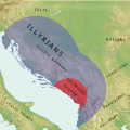
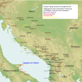
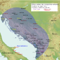
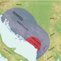
English: Simple Map of Illyrians, Illyria Barbara, Illyria Graeca, Illyrians Proper and Environs
  • carte des tribus illyriennes
  • illyrische Stamme Karte
  • Mappa di tribu illiriche
  • mapa de tribos ilirias
  • Mapa Ilirske plemena
  • mapa de las tribus de Illyrian
  • Fiset ilire harte
  • Χάρτης Ιλλυριών φυλών
  • Карта из иллирийских племен
  • Мапа илирског племена
Datum
Fons Opus proprium
Auctor MaryroseB54
Other versions

[recensere]

v1
v2
v3
v4
  • The central Balkan tribes in pre-Roman times: Triballi, Autariatae, Dardanians, Scordisci and Moesians by Fanula Papazoglu,1978,ISBN -9025607934
  • The Cambridge Ancient History, Volume 6: The Fourth Century BC by D. M. Lewis (Editor), John Boardman (Editor), Simon Hornblower (Editor), M. Ostwald (Editor),1994,ISBN 0521233488
  • The Cambridge Ancient History, Vol. 10: The Augustan Empire, 43 BC-AD 69 (Volume 10) by Alan Bowman, Edward Champlin, and Andrew Lintott,1996
  • Pannonia and Upper Moesia. A History of the Middle Danube Provinces of the Roman Empire. A Mocsy, S Frere
  • Dalmatia Tome 2 of History of the provinces of the Roman Empire by J. J. Wilkes,1969
  • Wilkes, J. J. The Illyrians, 1992,ISBN 0631198075,
  • Hammond, N. G. L. A History of Greece to 322 B.C., 1986, ISBN-10: 0198730950
  • The Loeb Editor's Notes, 28 Nova Epirus or Illyris Graeca (Epirus, Nova Illyria Graeca) "Nova Epirus or Illyris Graeca extended from the Drilo (Mod. Drina) River on the north to the Ceraunian Mts. on the south, thus comprising a large part of modern Albania. Immediately to the south of it to the Ambracian Gulf (Mod. Gulf of Arta) lay what is here called Old Epirus, approximately identical with the Epirus of modern Greece."
  • Blank map,File:Yugoslavia_topographic_base_map.svg

Potestas usoris

I, the copyright holder of this work, hereby publish it under the following license:
w:en:Creative Commons
attributio aequa parte
This file is licensed under the Creative Commons Attribution-Share Alike 4.0 International license.
Tibi licet:
  • communicare – copiare, distribuere et committere hoc opus
  • to remix – to adapt the work
His condicionibus:
  • attributio – You must give appropriate credit, provide a link to the license, and indicate if changes were made. You may do so in any reasonable manner, but not in any way that suggests the licensor endorses you or your use.
  • aequa parte – If you remix, transform, or build upon the material, you must distribute your contributions under the same or compatible license as the original.
Translate this file This SVG file contains embedded text that can be translated into your language, using any capable SVG editor, text editor or the SVG Translate tool. For more information see: About translating SVG files.
Annotations
InfoField
This image is annotated: View the annotations at Commons

Captions

Add a one-line explanation of what this file represents

Items portrayed in this file

depicts Anglica

copyrighted Anglica

19 Iunii 2016

Historia fasciculi

Presso die vel tempore fasciculum videbis, sicut tunc temporis apparuit.

Dies/TempusMinutioDimensionesUsorSententia
recentissima12:56, 23 Iunii 2016Minutum speculum redactionis 12:56, 23 Iunii 2016 factae1 600 × 1 600 (5.11 megaocteti)MaryroseB54User created page with UploadWizard

Ad hunc fasciculum nectit:

Usus fasciculi per inceptus Vicimediorum

Quae incepta Vici fasciculo utuntur:

Metadata