
Fasciculus:West Sussex UK location map.svg

Size of this PNG preview of this SVG file: 800 × 559 elementa imaginalia. Aliae mensurae: 320 × 223 elementa imaginalia | 640 × 447 elementa imaginalia | 1 024 × 715 elementa imaginalia | 1 280 × 894 elementa imaginalia | 2 560 × 1 788 elementa imaginalia | 1 425 × 995 elementa imaginalia.
Sua resolutio (fasciculus SVG, nominale 1 425 × 995 elementa imaginalia, magnitudo fasciculi: 1.49 megaocteti)
| Descriptio |
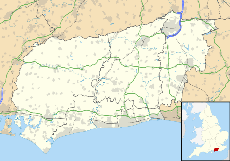
Map of West Sussex, UK with the following information shown:
Equirectangular map projection on WGS 84 datum, with N/S stretched 155% Geographic limits:
|
| Datum | |
| Fons |
|
| Auctor | Nilfanion, created using Ordnance Survey data |
| Permissio (Reusing this file) |
This file is licensed under the Creative Commons Attribution-Share Alike 3.0 Unported license. Attributio: Contains Ordnance Survey data © Crown copyright and database right
|
| Other versions | File:West Sussex UK district map (blank).svg - Blank map |
| SVG genesis |
.svg)
Historia fasciculi
Presso die vel tempore fasciculum videbis, sicut tunc temporis apparuit.
| Dies/Tempus | Minutio | Dimensiones | Usor | Sententia | |
|---|---|---|---|---|---|
| recentissima | 19:18, 26 Septembris 2010 | | 1 425 × 995 (1.49 megaocteti) | Nilfanion | {{Information |Description=Map of West Sussex, UK with the following information shown: *Administrative borders *Coastline, lakes and rivers *Roads and railways *Urban areas Equirectangular map projection on WGS 84 datum, with N/S stret |
Nexus ad fasciculum
Ad hunc fasciculum nectunt:
Usus fasciculi per inceptus Vicimediorum
Quae incepta Vici fasciculo utuntur:
- Usus in ar.wikipedia.org
- Usus in bg.wikipedia.org
- Usus in ceb.wikipedia.org
- Usus in en.wikipedia.org
- Fishbourne Roman Palace
- Chichester Cathedral
- Gatwick Airport
- WWT Arundel
- Amberley Museum & Heritage Centre
- Arundel
- Burgess Hill
- Shoreham-by-Sea
- Lancing, West Sussex
- Littlehampton
- East Grinstead
- Horsted Keynes
- Haywards Heath
- Bognor Regis
- Chichester
- Petworth
- Three Bridges, West Sussex
- Pease Pottage
- Southgate, West Sussex
- Pound Hill
- West Green, West Sussex
- Angmering
- Midhurst
- Broadfield, West Sussex
- Goring-by-Sea
- Tilgate
- RAF Tangmere
- Clapham, West Sussex
- Cuckfield
- Steyning
- Washington, West Sussex
- Pagham
- Chichester Cross
- Standen
- Gatwick Airport railway station
- Hurstpierpoint
- Bewbush
- Ifield, West Sussex
- Gossops Green
- Furnace Green
- Northgate, West Sussex
- Langley Green, West Sussex
- Manor Royal
- Maidenbower
- Worth, West Sussex
- Elmer, West Sussex
View more global usage of this file.