
Fasciculus:Map of Brunei Demis.png
Mensura huius perspectionis: 527 × 599 elementa imaginalia. Aliae mensurae: 211 × 240 elementa imaginalia | 422 × 480 elementa imaginalia | 938 × 1 066 elementa imaginalia.
Sua resolutio (938 × 1 066 elementa imaginalia, magnitudo fasciculi: 238 chiliocteti, typus MIME: image/png)
Summarium
| Descriptio |
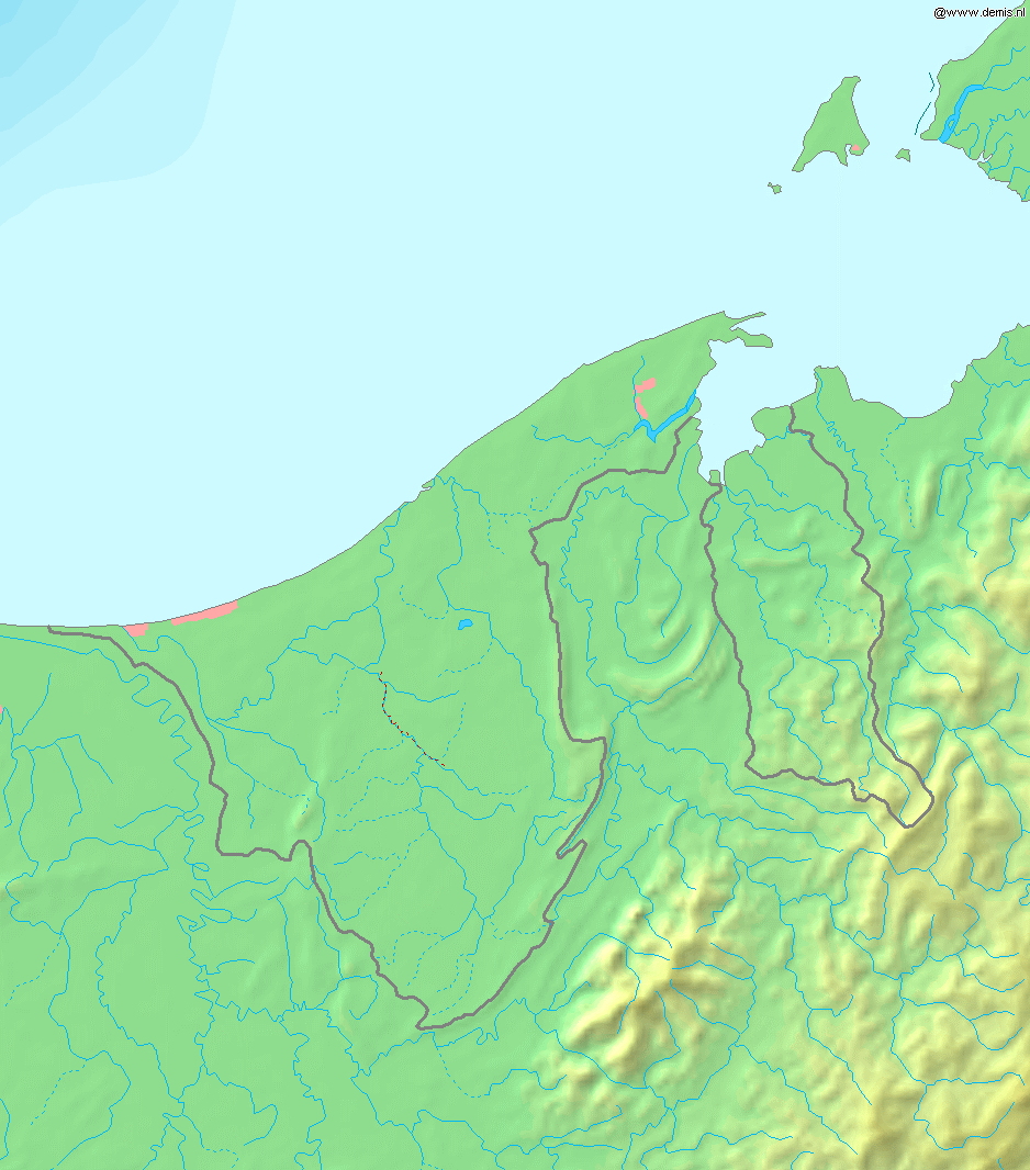
Deutsch: Topografische Karte von Brunei. Quadratische Plattkarte, Zentrum: 4°39′00″N 114°45′00″E / 4.65000°N 114.75000°E. Geographische Begrenzung der Karte:
English: Blank relief map of Brunei. Equirectangular projection centered at 4°39′00″N 114°45′00″E / 4.65000°N 114.75000°E. Geographic limits of the map:
Français : Carte du relief vierge du Brunei. Projection équirectangulaire centrée en 4°39′00″N 114°45′00″E / 4.65000°N 114.75000°E. Limites géographiques de la carte :
|
| Datum | |
| Fons | Opus proprium, using Demis data |
| Auctor | Mats Halldin (talk) |
Potestas usoris
This image is in the public domain because it came from the site https://www.demis.nl/products/web-map-server/examples/ and was released by the copyright holder. Permission is granted to copy, distribute and/or modify this map since it is based on free of copyright images from: www.demis.nl. See also approval email on de.wp and its clarification.
|
| This work has been released into the public domain by its copyright holder, www.demis.nl. This applies worldwide. In some countries this may not be legally possible; if so: www.demis.nl grants anyone the right to use this work for any purpose, without any conditions, unless such conditions are required by law.
|
Historia fasciculi
Presso die vel tempore fasciculum videbis, sicut tunc temporis apparuit.
| Dies/Tempus | Minutio | Dimensiones | Usor | Sententia | |
|---|---|---|---|---|---|
| recentissima | 18:11, 20 Decembris 2006 | | 938 × 1 066 (238 chiliocteti) | Mats Halldin~commonswiki | Map of Brunei Bounding box West 114°, South 3.8°, East 115.5°, North 5.5°. Center at {{coor d|4.65000|N|114.75000|E|scale:1020000}}. {{demis-pd}} Category:Maps of Brunei |
Nexus ad fasciculum
Ad hunc fasciculum nectunt:
Usus fasciculi per inceptus Vicimediorum
Quae incepta Vici fasciculo utuntur:
- Usus in ar.wikipedia.org
- Usus in az.wikipedia.org
- Usus in bg.wikipedia.org
- Usus in ca.wikipedia.org
- Usus in en.wikipedia.org
- Usus in ja.wikipedia.org
- Usus in ms.wikipedia.org
- Usus in pt.wikipedia.org
- Usus in sq.wikipedia.org
- Usus in te.wikipedia.org
- Usus in th.wikipedia.org
- Usus in uk.wikipedia.org
- Usus in vep.wikipedia.org
- Usus in zh-yue.wikipedia.org
- Usus in zh.wikipedia.org