
Fasciculus:Estoher - Vue panoramique (carte postale 1236).jpg

Mensura huius perspectionis: 800 × 517 elementa imaginalia. Aliae mensurae: 320 × 207 elementa imaginalia | 640 × 414 elementa imaginalia | 1 024 × 662 elementa imaginalia | 1 280 × 827 elementa imaginalia | 2 560 × 1 654 elementa imaginalia | 3 273 × 2 115 elementa imaginalia.
Sua resolutio (3 273 × 2 115 elementa imaginalia, magnitudo fasciculi: 1.69 megaocteti, typus MIME: image/jpeg)
.jpg)
Summarium
| Descriptio |
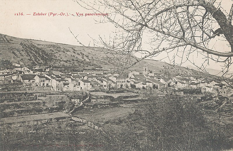
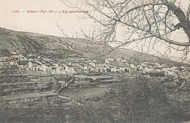
Français : Vue panoramique d'Estoher au début du 20ème siècle English: Postcard showing Estoher in the early 20th century |
| Datum | |
| Fons | Collection personnelle |
| Auctor | Anonyme (Imprimerie Brun Frères, Perpignan), début 20ème siècle |
| Camera location | | View this and other nearby images on: OpenStreetMap |
|---|
.jpg¶ms=042.601600_N_0002.486900_E_globe:Earth_type:camera__&language=la)
Potestas usoris
|
This work is in the public domain in its country of origin and other countries and areas where the copyright term is the author's life plus 100 years or fewer. | |
| This file has been identified as being free of known restrictions under copyright law, including all related and neighboring rights. | |
Historia fasciculi
Presso die vel tempore fasciculum videbis, sicut tunc temporis apparuit.
| Dies/Tempus | Minutio | Dimensiones | Usor | Sententia | |
|---|---|---|---|---|---|
| recentissima | 11:56, 23 Septembris 2014 | | 3 273 × 2 115 (1.69 megaocteti) | Culex | User created page with UploadWizard |
Nexus ad fasciculum
Ad hunc fasciculum nectit:
Usus fasciculi per inceptus Vicimediorum
Quae incepta Vici fasciculo utuntur:
- Usus in an.wikipedia.org
- Usus in ca.wikipedia.org
- Usus in ceb.wikipedia.org
- Usus in ce.wikipedia.org
- Usus in da.wikipedia.org
- Usus in el.wikipedia.org
- Usus in en.wikipedia.org
- Usus in eo.wikipedia.org
- Usus in es.wikipedia.org
- Usus in eu.wikipedia.org
- Usus in fr.wikipedia.org
- Usus in hu.wikipedia.org
- Usus in it.wikipedia.org
- Usus in lmo.wikipedia.org
- Usus in oc.wikipedia.org
- Usus in pl.wikipedia.org
- Usus in pt.wikipedia.org
- Usus in ro.wikipedia.org
- Usus in sh.wikipedia.org
- Usus in sk.wikipedia.org
- Usus in sr.wikipedia.org
- Usus in sv.wikipedia.org
- Usus in tt.wikipedia.org
- Usus in uk.wikipedia.org
- Usus in vec.wikipedia.org
- Usus in www.wikidata.org
- Usus in zh-min-nan.wikipedia.org
- Usus in zh.wikipedia.org
.jpg)