
Fasciculus:Denmark location map.svg

Size of this PNG preview of this SVG file: 703 × 600 elementa imaginalia. Aliae mensurae: 281 × 240 elementa imaginalia | 563 × 480 elementa imaginalia | 900 × 768 elementa imaginalia | 1 201 × 1 024 elementa imaginalia | 2 401 × 2 048 elementa imaginalia | 1 836 × 1 566 elementa imaginalia.
Sua resolutio (fasciculus SVG, nominale 1 836 × 1 566 elementa imaginalia, magnitudo fasciculi: 435 chiliocteti)
Summarium
| Descriptio |
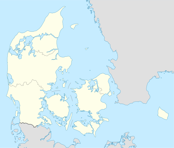
Deutsch: Positionskarte von Dänemark
Quadratische Plattkarte, N-S-Streckung 180 %. Geographische Begrenzung der Karte:
English: Location map of Denmark
Equirectangular projection, N/S stretching 180 %. Geographic limits of the map:
|
||
| Datum | |||
| Fons | Opus proprium, using United States National Imagery and Mapping Agency data | ||
| Auctor | NordNordWest | ||
| Other versions | Derivative works of this file: Regenbogen location map.svg | ||
| SVG genesis |
|

Potestas usoris
I, the copyright holder of this work, hereby publish it under the following licenses:

|
Licet hoc documentum exscribere vel distribuere vel demutare sub GNU Liberarum Litterarum Licentiae conditionibus in editione 1.2 aut in ulla editione recentiori a Fundatione Liberarum Programmationis Partium publicata; praeterquam Sectiones Immutabiles et Verba Involucra Adversa et Aversa. Licentiae exemplar praesto est in sectione intitulata GNU Free Documentation License. |
This file is licensed under the Creative Commons Attribution-Share Alike 3.0 Unported license.
- Tibi licet:
- communicare – copiare, distribuere et committere hoc opus
- to remix – to adapt the work
- His condicionibus:
- attributio – You must give appropriate credit, provide a link to the license, and indicate if changes were made. You may do so in any reasonable manner, but not in any way that suggests the licensor endorses you or your use.
- aequa parte – If you remix, transform, or build upon the material, you must distribute your contributions under the same or compatible license as the original.
Tibi typum permissionis ligere licet.
Historia fasciculi
Presso die vel tempore fasciculum videbis, sicut tunc temporis apparuit.
| Dies/Tempus | Minutio | Dimensiones | Usor | Sententia | |
|---|---|---|---|---|---|
| recentissima | 15:30, 25 Novembris 2022 | | 1 836 × 1 566 (435 chiliocteti) | GrandEscogriffe | more correct north-south stretching |
| 18:57, 25 Augusti 2008 |  | 1 836 × 1 479 (441 chiliocteti) | NordNordWest | size correction | |
| 08:53, 2 Iulii 2008 |  | 612 × 493 (434 chiliocteti) | NordNordWest | {{Information |Description= {{de|Positionskarte von Dänemark}} Quadratische Plattkarte, N-S-Streckung 170 %. Geographische Begrenzung der Karte: * N: 57.9° N * S: 54.3° N * W: 8.8° O * O: 15.4° O {{en|Location map of [[:en:Denmark|D |
Nexus ad fasciculum
Nullae paginae hoc fasciculo utuntur.
Usus fasciculi per inceptus Vicimediorum
Quae incepta Vici fasciculo utuntur:
- Usus in af.wikipedia.org
- Usus in ar.wikipedia.org
- Usus in az.wikipedia.org
- Usus in ba.wikipedia.org
- Usus in be-tarask.wikipedia.org
- Капэнгаген
- Гэрнінг
- Шаблён:Лякалізацыйная мапа Даніі
- Одэнсэ
- Лянгелян
- Фальстэр
- Стрэймай
- Сувурай
- Фуглёй
- Эстурой
- Сандой
- Кальсой
- Скувой
- Вагар
- Наўльсой
- Люйтля-Дуймун
- Віёй
- Свуйной
- Скаген
- Оргус
- Чэмпіянат Эўропы па гандболе сярод мужчынаў 2014 году
- Брэнбю
- Ольбарг
- Ранэрс
- Эсб’ерг
- Кольдынг
- Горсэнс
- Вайле
- Роскіле
- Гэльсынгёр
- Сылькебарг
- Нэствэд
- Фрэдэрысія
View more global usage of this file.