
Fasciculus:Ancient Regions Epirus and Macedon.png
Mensura huius perspectionis: 600 × 600 elementa imaginalia. Aliae mensurae: 240 × 240 elementa imaginalia | 480 × 480 elementa imaginalia.
Sua resolutio (800 × 800 elementa imaginalia, magnitudo fasciculi: 603 chiliocteti, typus MIME: image/png)
| Descriptio |
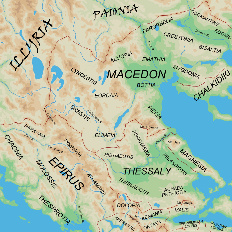
English: Map of the regions of Ancient Epirus and Macedon. |
| Datum | (UTC) |
| Fons |
|
| Auctor |
|
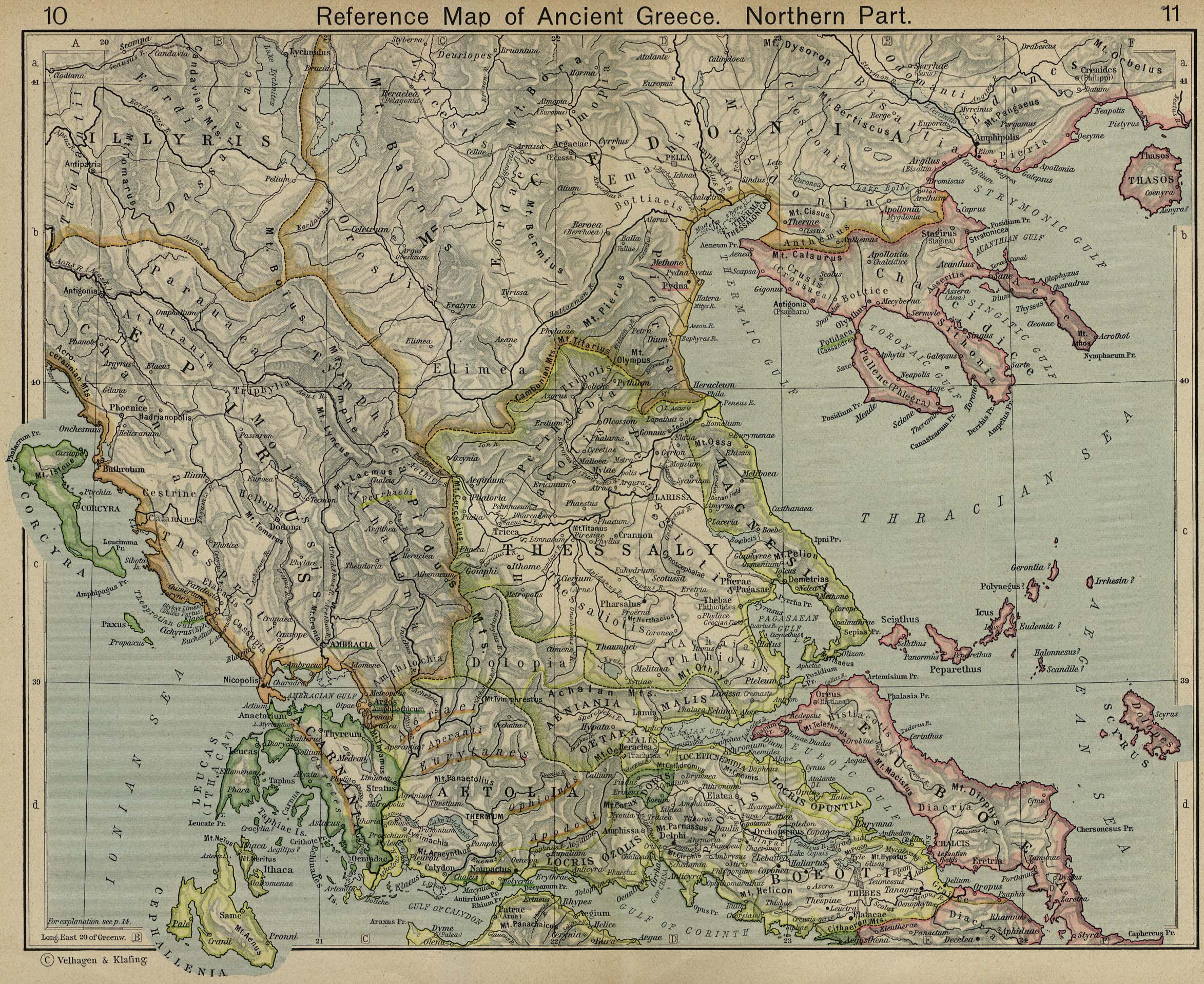
| This is a retouched picture, which means that it has been digitally altered from its original version. Modifications: Zoomed in, added more detail. The original can be viewed here: Ancient Regions Mainland Greece.png:
|
I, the copyright holder of this work, hereby publish it under the following licenses:
This file is licensed under the Creative Commons Attribution-Share Alike 2.5 Generic license.
- Tibi licet:
- communicare – copiare, distribuere et committere hoc opus
- to remix – to adapt the work
- His condicionibus:
- attributio – You must give appropriate credit, provide a link to the license, and indicate if changes were made. You may do so in any reasonable manner, but not in any way that suggests the licensor endorses you or your use.
- aequa parte – If you remix, transform, or build upon the material, you must distribute your contributions under the same or compatible license as the original.
| This file is licensed under the Creative Commons Attribution-Share Alike 3.0 Unported license. | ||
| ||
| This licensing tag was added to this file as part of the GFDL licensing update. |

|
Licet hoc documentum exscribere vel distribuere vel demutare sub GNU Liberarum Litterarum Licentiae conditionibus in editione 1.2 aut in ulla editione recentiori a Fundatione Liberarum Programmationis Partium publicata; praeterquam Sectiones Immutabiles et Verba Involucra Adversa et Aversa. Licentiae exemplar praesto est in sectione intitulata GNU Free Documentation License. |
Tibi typum permissionis ligere licet.
Original upload log
This image is a derivative work of the following images:
- File:Ancient_Regions_Mainland_Greece.png licensed with Cc-by-sa-2.5, Cc-by-sa-3.0-migrated, GFDL
- 2010-03-03T21:46:09Z MinisterForBadTimes 950x1100 (682330 Bytes) {{Information |Description={{en|Map of the major regions of mainland Ancient Greece.}} |Source=*blank map from [[:File:Map_greek_sanctuaries-en.svg|]] *Geographical information based on public domain map of Greece, from the P
Uploaded with derivativeFX
Historia fasciculi
Presso die vel tempore fasciculum videbis, sicut tunc temporis apparuit.
| Dies/Tempus | Minutio | Dimensiones | Usor | Sententia | |
|---|---|---|---|---|---|
| recentissima | 08:18, 24 Martii 2010 | | 800 × 800 (603 chiliocteti) | MinisterForBadTimes | Increased legibility, more labels |
| 07:55, 24 Martii 2010 |  | 800 × 800 (566 chiliocteti) | MinisterForBadTimes | {{Information |Description={{en|Map of the regions of Ancient Epirus and Macedon.}} |Source=*blank map from Map_greek_sanctuaries-en.svg *Geographical information based on public domain map of Greece, from the Perry- |
Nexus ad fasciculum
Ad hunc fasciculum nectit:
Usus fasciculi per inceptus Vicimediorum
Quae incepta Vici fasciculo utuntur:
- Usus in bg.wikipedia.org
- Usus in el.wikipedia.org
- Παιονία
- Βοττιαία
- Μυγδονία (η Μακεδονική)
- Εορδαία
- Αλμωπία
- Κρηστωνία
- Ελίμεια
- Ορεστίδα
- Λυγκηστίδα
- Πελαγονία
- Σιντική
- Οδομαντική
- Ηδωνίδα
- Ιστορία της Ηπείρου
- Δευρίοπος
- Χαονία
- Περιοχές της αρχαίας Ελλάδας
- Κοινό των Χαλκιδέων
- Αμφαξίτιδα
- Άνω Μακεδονία
- Τυμφαία
- Πρότυπο:Ιστορικές περιοχές της Μακεδονίας
- Βισαλτία
- Κάτω Μακεδονία
- Αρχαία Ημαθία
- Usus in en.wikipedia.org
- Usus in fi.wikipedia.org
- Usus in fr.wikipedia.org
- Usus in it.wikipedia.org
- Usus in oc.wikipedia.org
- Usus in pt.wikipedia.org
- Usus in zh.wikipedia.org