
Fasciculus:Physical map of Tibet.png
Mensura huius perspectionis: 800 × 471 elementa imaginalia. Aliae mensurae: 320 × 188 elementa imaginalia | 640 × 376 elementa imaginalia | 833 × 490 elementa imaginalia.
Sua resolutio (833 × 490 elementa imaginalia, magnitudo fasciculi: 446 chiliocteti, typus MIME: image/png)
Summarium
| Descriptio |
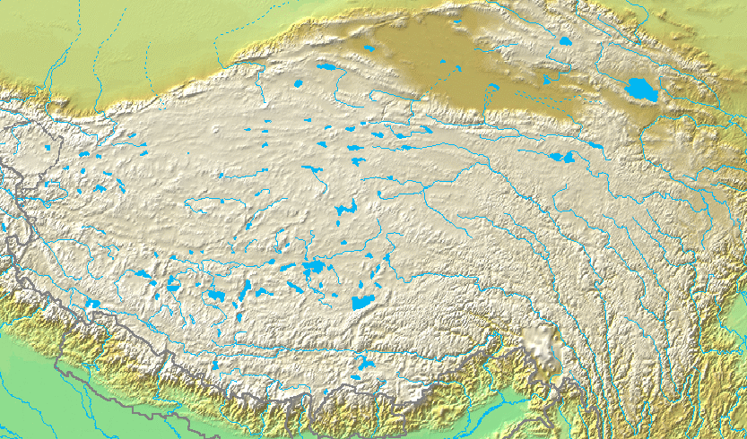
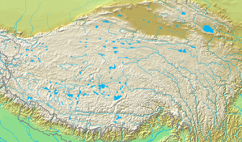
English: Topographic map of the Tibetan Plateau in Asia.
Français : Carte topographique du plateau tibetain.
|
||||
| Datum | Dies ignota | ||||
| Fons | http://www.demis.nl/home/pages/Gallery/examples.htm via File:Topografic map of Tibetan Plateau.png | ||||
| Auctor | Unknown author. Cropped by User:Andrew Dalby | ||||
| Permissio (Reusing this file) |
|
Historia fasciculi
Presso die vel tempore fasciculum videbis, sicut tunc temporis apparuit.
| Dies/Tempus | Minutio | Dimensiones | Usor | Sententia | |
|---|---|---|---|---|---|
| recentissima | 14:05, 15 Iulii 2019 | | 833 × 490 (446 chiliocteti) | Andrew Dalby | {{information |Description= {{en|Topographic map of the '''{{C|Tibetan Plateau|Tibetan Plateau}}''' in {{C|Asia}}. ::*Bounding box West 66°, South 23°, East 108°, North 42°.}} {{fr|Carte topographique du '''{{C|Tibetan Plateau|plateau tibetain}}'''. ::*Cette carte est inscrite dans le rectangle : 66° ouest, 23° sud, 108° est, 42° nord.}} |Source= http://www.demis.nl/home/pages/Gallery/examples.htm via File:Topografic map of Tibetan Plateau.png |Date={{other date|?}} |Author={{unknown|A... |
Nexus ad fasciculum
Ad hunc fasciculum nectunt: