
Fasciculus:Mongolia (orthographic projection).svg

Size of this PNG preview of this SVG file: 553 × 553 elementa imaginalia. Aliae mensurae: 240 × 240 elementa imaginalia | 480 × 480 elementa imaginalia | 768 × 768 elementa imaginalia | 1 024 × 1 024 elementa imaginalia | 2 048 × 2 048 elementa imaginalia.
Sua resolutio (fasciculus SVG, nominale 553 × 553 elementa imaginalia, magnitudo fasciculi: 301 chiliocteti)
Summarium
| Descriptio |
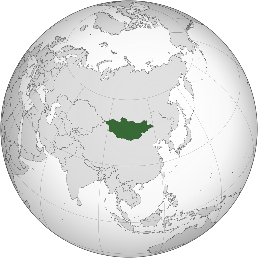
English: Orthographic Projection of Mongolia |
||
| Fons | Opus proprium | ||
| Auctor | ASDFGHJ | ||
| Other versions |
.svg)
|
.svg)
.svg)
.svg)
.svg)
.svg)
.svg)
.svg)
.svg)
.svg)
.svg)
.svg)
.svg)
.svg)
.svg)
.svg)
.svg)
.svg)
.svg)
.svg)
.svg)
.svg)
.svg)
.svg)
.svg)
.svg)
.svg)
.svg)
.svg)
.svg)
.svg)
.svg)
.svg)
.svg)
.svg)
.svg)
.svg)
.svg)
.svg)
.svg)
.svg)
.svg)
.svg)
.svg)
.svg)
.svg)
.svg)
.svg)
.svg)
.svg)
.svg)
.svg)
.svg)
.svg)
.svg)
.svg)
.svg)
.svg)
.svg)
.svg)
.svg)
.svg)
.svg)
.svg)
.svg)
.svg)
.svg)
.svg)
.svg)
.svg)
.svg)
.svg)
.svg)
.svg)

.svg)

.svg)

.svg)
.svg)
.svg)
.svg)
.svg)
.svg)
.svg)


.svg)
.svg)
.svg)
.svg)
.svg)
.svg)
.svg)

.svg)
.svg)
.svg)
.svg)
.svg)
.svg)
.svg)
.svg)
.svg)
.svg)

.svg)
.svg)
.svg)
.svg)
.svg)
.svg)
.svg)
_without_national_boundaries.svg)
.svg)
.svg)
.svg)
.svg)
.svg)
.svg)

.svg)
.svg)
.png)
.svg)
.svg)
.svg)
.svg)

.svg)
.svg)
.svg)
.svg)
.svg)
.svg)
.svg)
.svg)
.svg)
.svg)
.svg)

.svg)
.svg)
.svg)
.svg)
.svg)
.svg)
.svg)
.svg)
.svg)

.svg)
.svg)

.svg)
.svg)
.svg)
.svg)
.svg)
.svg)
.svg)
.svg)
.svg)
.svg)
.svg)
.svg)
.svg)
.svg)
.svg)
.svg)
.svg)
.svg)
.svg)
.svg)
.svg)
.svg)
.svg)
.svg)
.svg)
.svg)
.svg)
_-_Crimea_disputed.svg)
.svg)
.svg)
.svg)
.svg)
.svg)
.svg)
.svg)
.svg)
.svg)
.svg)
.svg)
_political.svg)
.svg)
.svg)
.svg)
.svg)
_-_Crimea_disputed_-_no_borders.svg)
.svg)
.svg)
.svg)
.svg)
.svg)
.svg)
.svg)
.svg)
.svg)
.svg)
.svg)

.svg)
.svg)
.svg)

.png)
.svg)
.svg)
.svg)
.svg)
.svg)
.svg)
.svg)
.svg)
.svg)
.svg)
.svg)
.svg)
.svg)
.svg)
.svg)
.svg)
.svg)
.svg)
.svg)
.svg)
.svg)
.svg)
.svg)
.svg)
.svg)
.svg)
.svg)
.svg)
.svg)
.svg)
.svg)
.svg)
.svg)
.svg)
.png)
.svg)
.svg)
.svg)
_(orthographic_projection).png)
.svg)
.svg)
.svg)
Potestas usoris
I, the copyright holder of this work, hereby publish it under the following licenses:
This file is licensed under the Creative Commons Attribution-Share Alike 3.0 Unported license.
- Tibi licet:
- communicare – copiare, distribuere et committere hoc opus
- to remix – to adapt the work
- His condicionibus:
- attributio – You must give appropriate credit, provide a link to the license, and indicate if changes were made. You may do so in any reasonable manner, but not in any way that suggests the licensor endorses you or your use.
- aequa parte – If you remix, transform, or build upon the material, you must distribute your contributions under the same or compatible license as the original.

|
Licet hoc documentum exscribere vel distribuere vel demutare sub GNU Liberarum Litterarum Licentiae conditionibus in editione 1.2 aut in ulla editione recentiori a Fundatione Liberarum Programmationis Partium publicata; praeterquam Sectiones Immutabiles et Verba Involucra Adversa et Aversa. Licentiae exemplar praesto est in sectione intitulata GNU Free Documentation License. |
Tibi typum permissionis ligere licet.
Historia fasciculi
Presso die vel tempore fasciculum videbis, sicut tunc temporis apparuit.
| Dies/Tempus | Minutio | Dimensiones | Usor | Sententia | |
|---|---|---|---|---|---|
| recentissima | 12:12, 22 Iunii 2022 | | 553 × 553 (301 chiliocteti) | NexusKnots | Reverted to version as of 12:40, 4 August 2013 (UTC) Somaliland declared independence from Somalia in 1991 and Kosovo declared its independence on 17/2/2008. |
| 23:35, 16 Martii 2015 |  | 553 × 553 (296 chiliocteti) | Flappiefh | Removed Somaliland and Kosovo. Separated Western Sahara and Morroco. | |
| 12:40, 4 Augusti 2013 |  | 553 × 553 (301 chiliocteti) | Flappiefh | Added South Sudan. | |
| 05:30, 6 Iulii 2009 |  | 541 × 541 (499 chiliocteti) | ASDFGHJ | == Summary == {{Information |Description={{en|1=Orthographic Projection of Mongolia}} |Source=Own work by uploader |Author=ASDFGHJ |Date= |Permission= |other_versions={{User:Ssolbergj/orthographic}} }} <!--{{ImageUpload|full}}--> == [[Co |
Nexus ad fasciculum
Nullae paginae hoc fasciculo utuntur.
Usus fasciculi per inceptus Vicimediorum
Quae incepta Vici fasciculo utuntur:
- Usus in ady.wikipedia.org
- Usus in af.wikipedia.org
- Usus in ang.wikipedia.org
- Usus in ar.wikipedia.org
- منغوليا
- الجمهورية الشعبية المنغولية
- بوابة:منغوليا/واجهة
- بوابة:منغوليا
- قائمة الدول ذات السيادة والأقاليم التابعة في آسيا
- معاملة المثليين في منغوليا
- مستخدم:جار الله/قائمة صور مقالات العلاقات الثنائية
- العلاقات الأمريكية المنغولية
- العلاقات الأنغولية المنغولية
- العلاقات الكورية الجنوبية المنغولية
- العلاقات الإريترية المنغولية
- العلاقات السويسرية المنغولية
- العلاقات الألمانية المنغولية
- العلاقات الليختنشتانية المنغولية
- العلاقات البوليفية المنغولية
- العلاقات المنغولية الموزمبيقية
- العلاقات الألبانية المنغولية
- العلاقات البلجيكية المنغولية
- العلاقات الإثيوبية المنغولية
- العلاقات البيلاروسية المنغولية
- العلاقات الطاجيكستانية المنغولية
- العلاقات الرومانية المنغولية
- العلاقات الأرجنتينية المنغولية
- العلاقات الغامبية المنغولية
- العلاقات القبرصية المنغولية
- العلاقات السيراليونية المنغولية
- العلاقات المنغولية النيبالية
- العلاقات الليبيرية المنغولية
- العلاقات التشيكية المنغولية
- العلاقات المنغولية الميانمارية
- العلاقات العراقية المنغولية
- العلاقات البريطانية المنغولية
- العلاقات الكندية المنغولية
- العلاقات الكوبية المنغولية
- العلاقات الكورية الشمالية المنغولية
- العلاقات الكوستاريكية المنغولية
- العلاقات الكولومبية المنغولية
- العلاقات الكيريباتية المنغولية
- العلاقات الكينية المنغولية
- العلاقات اللاتفية المنغولية
- العلاقات اللاوسية المنغولية
- العلاقات اللبنانية المنغولية
- العلاقات اللوكسمبورغية المنغولية
- العلاقات الليبية المنغولية
- العلاقات الليتوانية المنغولية
- العلاقات الليسوتوية المنغولية
- العلاقات المالاوية المنغولية
View more global usage of this file.
.svg)
.svg)