
Fasciculus:Land Use in the Potomac Basin.gif
Mensura huius perspectionis: 800 × 598 elementa imaginalia. Aliae mensurae: 320 × 239 elementa imaginalia | 640 × 479 elementa imaginalia | 900 × 673 elementa imaginalia.
Sua resolutio (900 × 673 elementa imaginalia, magnitudo fasciculi: 232 chiliocteti, typus MIME: image/gif, 0.2 s)
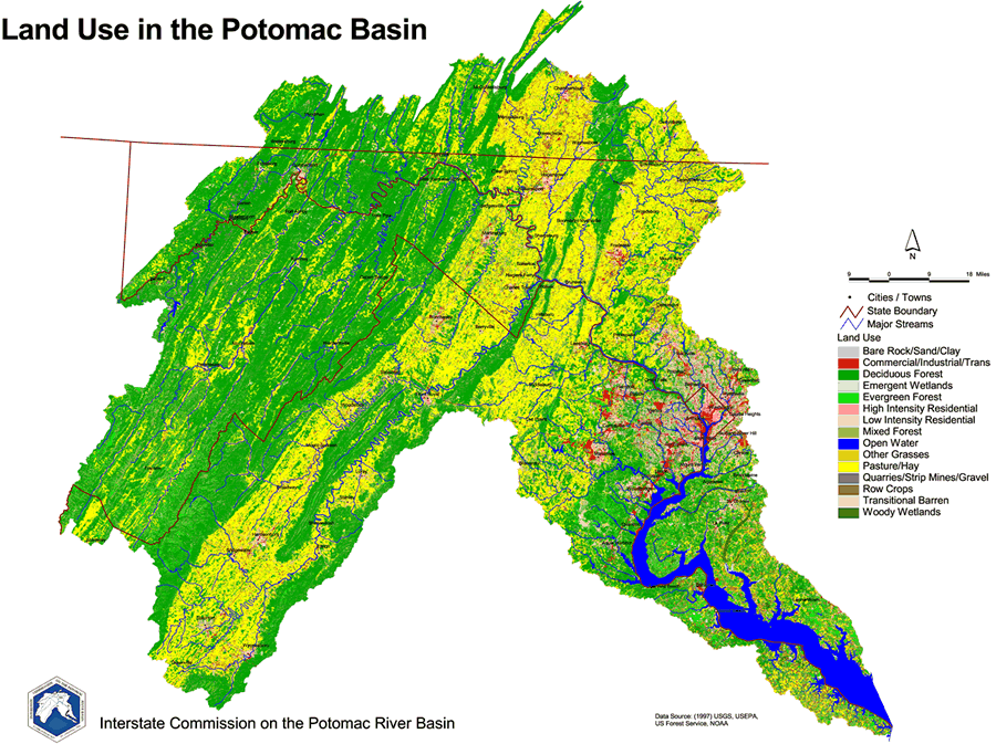
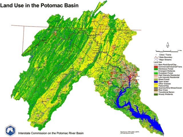
English: 1997 Land Use Map of the Potomac River Basin provided to the public domain by the U.S. Department of the Interior and the U.S. Geological Survey.
This image is in the public domain in the United States because it only contains materials that originally came from the United States Geological Survey, an agency of the United States Department of the Interior. For more information, see the official USGS copyright policy.
|
Historia fasciculi
Presso die vel tempore fasciculum videbis, sicut tunc temporis apparuit.
| Dies/Tempus | Minutio | Dimensiones | Usor | Sententia | |
|---|---|---|---|---|---|
| recentissima | 19:44, 20 Martii 2006 | | 900 × 673 (232 chiliocteti) | West Virginian | 1997 Land Use Map of the Potomac River Basin provided to the public domain by the U.S. Department of the Interior and the U.S. Geological Survey. {{USGS}} |
Nexus ad fasciculum
Ad hunc fasciculum nectit:
Usus fasciculi per inceptus Vicimediorum
Quae incepta Vici fasciculo utuntur:
- Usus in ar.wikipedia.org
- Usus in azb.wikipedia.org
- Usus in de.wikipedia.org
- Usus in el.wikipedia.org
- Usus in en.wikipedia.org
- Usus in es.wikipedia.org
- Usus in gl.wikipedia.org
- Usus in ja.wikipedia.org
- Usus in ko.wikipedia.org