
Fasciculus:Jolfa-Aras2.jpg
Mensura huius perspectionis: 800 × 598 elementa imaginalia. Aliae mensurae: 320 × 239 elementa imaginalia | 640 × 479 elementa imaginalia | 1 024 × 766 elementa imaginalia | 1 280 × 957 elementa imaginalia | 2 032 × 1 520 elementa imaginalia.
Sua resolutio (2 032 × 1 520 elementa imaginalia, magnitudo fasciculi: 381 chiliocteti, typus MIME: image/jpeg)
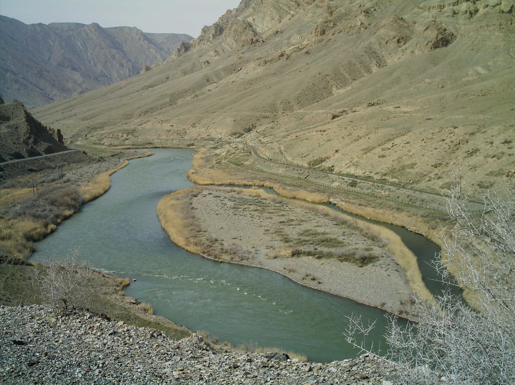
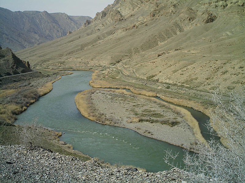
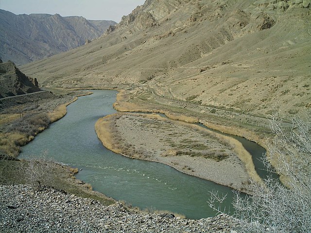
| Descriptio | Aras river in the vicinity of Julfa-Iran (Left hand Iran - Right Hand Nakhichevan) - March 2006. The island seen in this picture is on the Iranian side of the border and is named Kasiri Island, after lieutenant Nourollah Kasiri. Kasiri was an Imperial Iranian Army cartographer who acted as Iran's representative in border dispute with the Soviet Union and persuaded the Soviets to accept this river island as Iranian by risking his own life. | ||||||||
| Datum | |||||||||
| Fons | en:image:Jolfa-Aras2.JPG | ||||||||
| Auctor | en:user:M karzarj | ||||||||
| Permissio (Reusing this file) |
I, the copyright holder of this work, hereby publish it under the following licenses:
Tibi typum permissionis ligere licet. |
||||||||
| Other versions | en:image:Jolfa-Aras2.JPG |

| Camera location | | View this and other nearby images on: OpenStreetMap |
|---|
Historia fasciculi
Presso die vel tempore fasciculum videbis, sicut tunc temporis apparuit.
| Dies/Tempus | Minutio | Dimensiones | Usor | Sententia | |
|---|---|---|---|---|---|
| recentissima | 18:11, 4 Septembris 2006 | | 2 032 × 1 520 (381 chiliocteti) | Katpatuka | == Summary == Aras river in the vicinity of Julfa-Iran (Left hand Iran - Right Hand Nakhichevan) - March 2006 == Licensing == {{GFDL-self}} |
Nexus ad fasciculum
Ad hunc fasciculum nectit:
Usus fasciculi per inceptus Vicimediorum
Quae incepta Vici fasciculo utuntur:
- Usus in af.wikipedia.org
- Usus in ar.wikipedia.org
- Usus in arz.wikipedia.org
- Usus in ast.wikipedia.org
- Usus in azb.wikipedia.org
- Usus in az.wikipedia.org
- Usus in az.wikibooks.org
- Usus in az.wiktionary.org
- Usus in be.wikipedia.org
- Usus in bg.wikipedia.org
- Usus in bn.wikipedia.org
- Usus in bs.wikipedia.org
- Usus in ca.wikipedia.org
- Usus in ceb.wikipedia.org
- Usus in cs.wikipedia.org
- Usus in da.wikipedia.org
- Usus in de.wikipedia.org
- Usus in en.wikipedia.org
- Usus in en.wikivoyage.org
- Usus in en.wiktionary.org
- Usus in eo.wikipedia.org
- Usus in es.wikipedia.org
- Usus in et.wikipedia.org
View more global usage of this file.