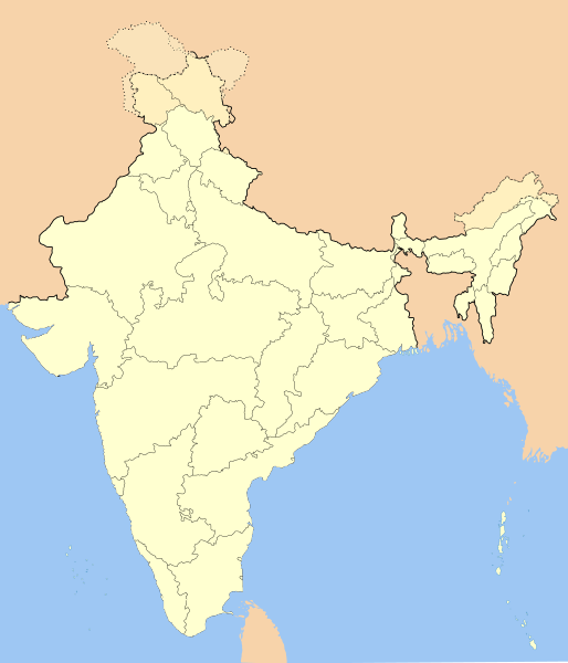
Fasciculus:India-locator-map-blank.svg

Size of this PNG preview of this SVG file: 514 × 600 elementa imaginalia. Aliae mensurae: 206 × 240 elementa imaginalia | 411 × 480 elementa imaginalia | 658 × 768 elementa imaginalia | 877 × 1 024 elementa imaginalia | 1 755 × 2 048 elementa imaginalia | 1 486 × 1 734 elementa imaginalia.
Sua resolutio (fasciculus SVG, nominale 1 486 × 1 734 elementa imaginalia, magnitudo fasciculi: 252 chiliocteti)
Historia fasciculi
Presso die vel tempore fasciculum videbis, sicut tunc temporis apparuit.
| Dies/Tempus | Minutio | Dimensiones | Usor | Sententia | |
|---|---|---|---|---|---|
| recentissima | 14:01, 14 Octobris 2020 |  | 1 486 × 1 734 (252 chiliocteti) | NordNordWest | upd Telangana/Andhra Pradesh |
| 17:48, 25 Iulii 2020 |  | 1 486 × 1 734 (252 chiliocteti) | NordNordWest | Jammu and Kashmir/Ladakh | |
| 01:42, 1 Aprilis 2017 |  | 1 486 × 1 734 (337 chiliocteti) | Utcursch | Moved Telangana to states layer | |
| 14:08, 29 Ianuarii 2016 |  | 1 486 × 1 734 (379 chiliocteti) | Csyogi | Telangana update | |
| 15:36, 16 Maii 2006 |  | 1 486 × 1 734 (421 chiliocteti) | Nichalp | Siachen edits | |
| 12:49, 13 Maii 2006 |  | 1 486 × 1 734 (424 chiliocteti) | Nichalp | Siachen correction | |
| 12:43, 13 Maii 2006 |  | 1 486 × 1 734 (422 chiliocteti) | Nichalp | border changes | |
| 05:53, 9 Maii 2006 |  | 1 486 × 1 734 (421 chiliocteti) | Nichalp | Updates as suggested in FPC | |
| 07:48, 7 Maii 2006 |  | 1 486 × 1 734 (421 chiliocteti) | Nichalp | Version 2; added some additional disputed areas in the Western sector | |
| 18:27, 6 Maii 2006 |  | 1 486 × 1 734 (416 chiliocteti) | Nichalp | Blank locator map of India SVG Map drawn by me, ~~~~ category:Maps of India |
Nexus ad fasciculum
Nullae paginae hoc fasciculo utuntur.
Usus fasciculi per inceptus Vicimediorum
Quae incepta Vici fasciculo utuntur:
- Usus in as.wikipedia.org
- Usus in as.wikiquote.org
- Usus in awa.wikipedia.org
- खाँचा:ज्ञानसन्दूक भारत कय क्षेत्र
- भारत कय राज्य
- भारत कय संघ राज्यक्षेत्र
- खाँचा:India States and Territories Labelled Map
- खाँचा:Infobox Indian Jurisdiction
- खाँचा:Infobox Indian Jurisdiction/Examples/city
- खाँचा:Infobox Indian Jurisdiction/Examples/district
- खाँचा:Infobox Indian Jurisdiction/Examples/neighbourhood
- खाँचा:Infobox Indian Jurisdiction/Examples/protected area
- खाँचा:Infobox Indian Jurisdiction/Examples/state
- खाँचा:Infobox Indian Jurisdiction/Examples/suburb
- खाँचा:Infobox Indian Jurisdiction/Examples/town
- खाँचा:Infobox Indian Jurisdiction/Examples/village
- खाँचा:Infobox Indian Jurisdiction/Sandbox
- खाँचा:Infobox Indian Jurisdiction/Sandbox/doc
- खाँचा:Infobox Indian Jurisdiction/doc
- खाँचा:ज्ञानसन्दूक भारत कय क्षेत्र/doc
- सीधी
- Usus in ban.wikipedia.org
- Usus in bn.wikipedia.org
- Usus in bpy.wikipedia.org
View more global usage of this file.


