
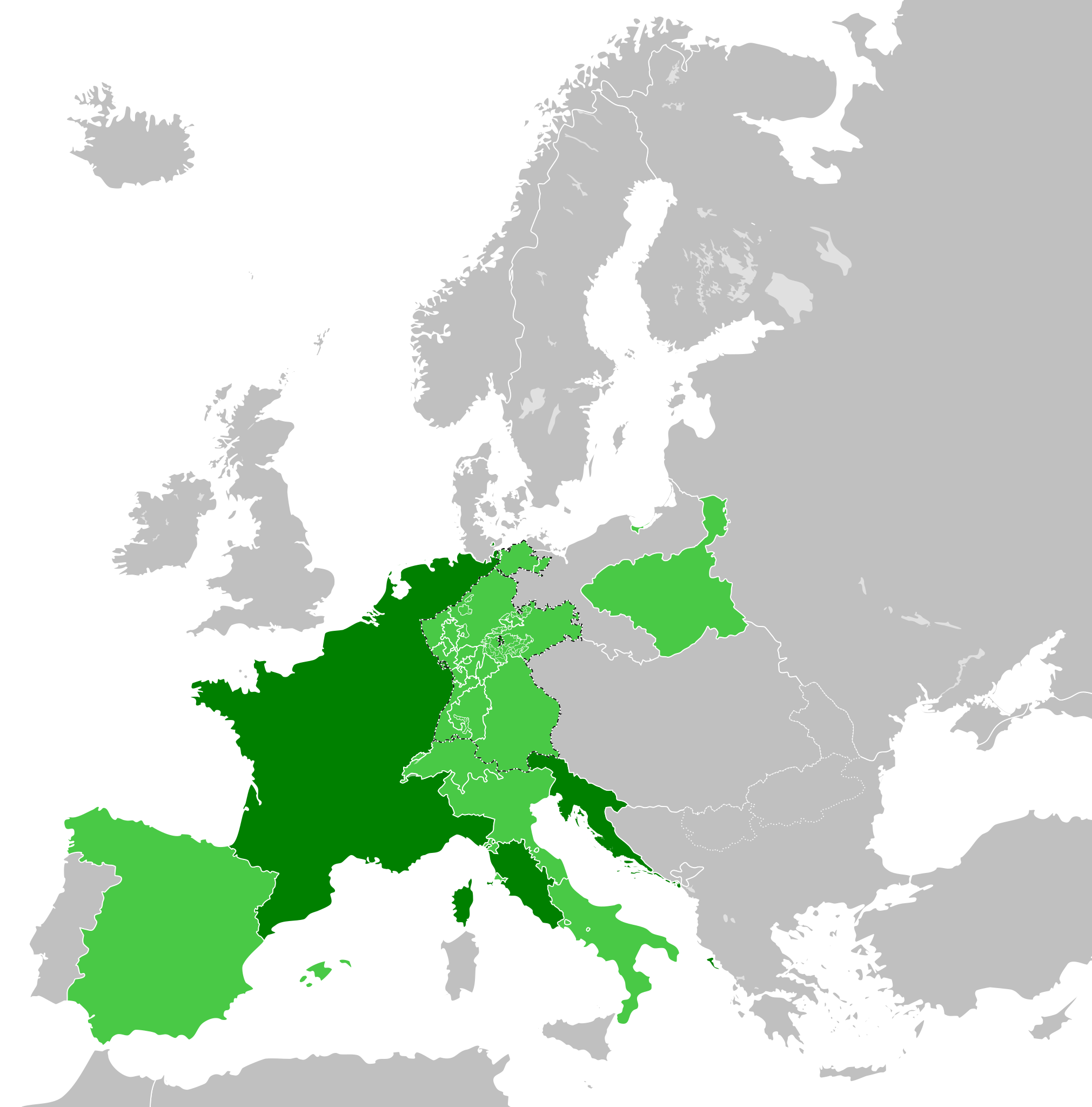
Fasciculus:French Empire (1812).svg

Size of this PNG preview of this SVG file: 450 × 456 elementa imaginalia. Aliae mensurae: 237 × 240 elementa imaginalia | 474 × 480 elementa imaginalia | 758 × 768 elementa imaginalia | 1 011 × 1 024 elementa imaginalia | 2 021 × 2 048 elementa imaginalia.
Sua resolutio (fasciculus SVG, nominale 450 × 456 elementa imaginalia, magnitudo fasciculi: 632 chiliocteti)
Summarium


.svg)
.svg)
.svg)
.svg)
.svg)


.svg)
.svg)
.svg)


.png)
.png)


.svg)


.svg)

.svg)


.svg)
.svg)
.svg)
.svg)


.svg)
.png)


.svg)


.svg)
.svg)


.svg)


.svg)


.svg)
.svg)
.svg)
.svg)
.svg)
.svg)
.svg)
.svg)
_cropped.svg)
.svg)
.svg)
.svg)
.svg)
.svg)
.svg)
.svg)
.svg)
.svg)
.svg)
.svg)
.svg)
.svg)
.svg)
.svg)
.svg)
.svg)
.svg)
.svg)
.svg)
.svg)
.svg)
.svg)
.svg)
.svg)
.svg)
.svg)
.svg)
.svg)
.svg)
.svg)
.svg)
.svg)
.svg)
.svg)
.svg)
.svg)
.svg)
.svg)
.svg)
.svg)
.svg)
.svg)
.svg)
.svg)
Historia fasciculi
Presso die vel tempore fasciculum videbis, sicut tunc temporis apparuit.
| Dies/Tempus | Minutio | Dimensiones | Usor | Sententia | |
|---|---|---|---|---|---|
| recentissima | 22:32, 30 Maii 2019 | | 450 × 456 (632 chiliocteti) | Cplakidas | correcting the Ionan Islands: they were not a client state, but annexed to France; and by 1812, most of them apart from Corfu and Paxoi (not depicted in this map) were under British control. |
| 15:03, 5 Ianuarii 2018 |  | 450 × 456 (611 chiliocteti) | TRAJAN 117 | +++ | |
| 11:52, 27 Decembris 2017 |  | 450 × 456 (610 chiliocteti) | TRAJAN 117 | +++ | |
| 07:45, 24 Decembris 2017 |  | 450 × 456 (610 chiliocteti) | TRAJAN 117 | +++ | |
| 01:59, 24 Decembris 2017 |  | 450 × 456 (610 chiliocteti) | TRAJAN 117 | Update | |
| 07:49, 12 Decembris 2013 |  | 450 × 456 (588 chiliocteti) | TRAJAN 117 | Coloured in Ionian Islands. | |
| 16:07, 5 Octobris 2013 |  | 450 × 456 (588 chiliocteti) | TRAJAN 117 | Updated | |
| 01:42, 14 Maii 2013 |  | 450 × 456 (449 chiliocteti) | TRAJAN 117 | Minor fix | |
| 01:38, 14 Maii 2013 |  | 450 × 456 (449 chiliocteti) | TRAJAN 117 | {{Information |Description ={{en|1=The French Empire in 1812.}} |Source ={{own}} {{AttribSVG|First French Empire 1812.svg|Alphathon}} |Author =TRAJAN 117 {{created with Inkscape}} |Date =2013-05-14 |Perm... |
Nexus ad fasciculum
Ad hunc fasciculum nectit:
Usus fasciculi per inceptus Vicimediorum
Quae incepta Vici fasciculo utuntur:
- Usus in als.wikipedia.org
- Usus in arc.wikipedia.org
- Usus in ar.wikipedia.org
- Usus in arz.wikipedia.org
- Usus in ast.wikipedia.org
- Usus in az.wikipedia.org
- Usus in cs.wikipedia.org
- Usus in de.wikipedia.org
- Usus in en.wikipedia.org
- Usus in en.wikibooks.org
- Usus in es.wikipedia.org
- Usus in fa.wikipedia.org
- Usus in fi.wikipedia.org
- Usus in gl.wikipedia.org
- Usus in hy.wikipedia.org
- Usus in id.wikipedia.org
- Usus in it.wikipedia.org
- Usus in ja.wikipedia.org
- Usus in ka.wikipedia.org
- Usus in ko.wikipedia.org
- Usus in mt.wikipedia.org
- Usus in no.wikipedia.org
- Usus in pl.wikipedia.org
- Usus in pt.wikipedia.org
- Usus in ro.wikipedia.org
- Usus in ru.wikibooks.org
- Usus in sh.wikipedia.org
- Usus in simple.wikipedia.org
- Usus in tr.wikipedia.org
- Usus in vi.wikipedia.org
- Usus in www.wikidata.org
.svg)