
Fasciculus:Deutsches Reich (Karte) Mecklenburg-Strelitz.svg

Size of this PNG preview of this SVG file: 650 × 545 elementa imaginalia. Aliae mensurae: 286 × 240 elementa imaginalia | 573 × 480 elementa imaginalia | 916 × 768 elementa imaginalia | 1 221 × 1 024 elementa imaginalia | 2 443 × 2 048 elementa imaginalia.
Sua resolutio (fasciculus SVG, nominale 650 × 545 elementa imaginalia, magnitudo fasciculi: 1.04 megaocteti)
_Mecklenburg-Strelitz.svg)
| Descriptio |
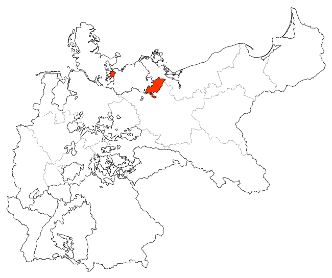
Deutsch: Karte des Deutschen Reiches zu Anbeginn des 20. Jahrhunderts. Neben den einzelnen Gliedstaaten sind auch die preußischen Provinzen auf der Karte verzeichnet. Die Lage von Mecklenburg-Strelitz ist hervorgehoben. |
| Datum | |
| Fons | Map based upon map data of the IEG-Maps project by Andreas Kunz, B. Johnen and Joachim Robert Moeschl of the University of Mainz. For further info visit: http://www.ieg-maps.uni-mainz.de |
| Auctor | David Liuzzo |
| Permissio (Reusing this file) |
This file is licensed under the Creative Commons Attribution-Share Alike 2.0 Germany license.
 |
Historia fasciculi
Presso die vel tempore fasciculum videbis, sicut tunc temporis apparuit.
| Dies/Tempus | Minutio | Dimensiones | Usor | Sententia | |
|---|---|---|---|---|---|
| recentissima | 19:20, 9 Ianuarii 2010 | | 650 × 545 (1.04 megaocteti) | Maproom | Made M-Strelitz red, to make it more visible |
| 15:32, 29 Iunii 2007 |  | 650 × 545 (1.04 megaocteti) | N3MO | ||
| 14:13, 30 Iulii 2006 |  | 650 × 545 (797 chiliocteti) | David Liuzzo | {{Information| |Description= {{de|Karte des Deutschen Reiches zu Anbeginn des 20. Jahrhunderts. Neben den einzelnen Gliedstaaten sind auch die preußischen Provinzen auf der Karte verzeichnet. Die Lage von '''Mecklenburg-Strelitz''' ist hervorgehoben.}} | |
Nexus ad fasciculum
Nullae paginae hoc fasciculo utuntur.
_Mecklenburg-Strelitz.svg)