
Fasciculus:Tamil distribution.png

Mensura huius perspectionis: 532 × 599 elementa imaginalia. Aliae mensurae: 213 × 240 elementa imaginalia | 426 × 480 elementa imaginalia | 682 × 768 elementa imaginalia | 909 × 1 024 elementa imaginalia | 1 649 × 1 858 elementa imaginalia.
Sua resolutio (1 649 × 1 858 elementa imaginalia, magnitudo fasciculi: 567 chiliocteti, typus MIME: image/png)
| Titulus |
Tamil speakers map |
| Description |
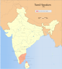
Detail of Image:Tamil speakers map.svg; Areas in India and Sri Lanka where Tamil is spoken (1961). |
| Datum | |
| Fons |
Opus proprium |
| Auctor | |
| Permissio (Reusing this file) |
I, the copyright holder of this work, hereby publish it under the following license: This file is licensed under the Creative Commons Attribution-Share Alike 3.0 Unported license.
|
| Geotemporal data | |
| Date depicted | second half of saeculum 20 et saeculum 21 |
| Georeferencing | If inappropriate please set warp_status = skip to hide. |
| Archival data | |
| Notae | Part of WikiProject India Maps |
Historia fasciculi
Presso die vel tempore fasciculum videbis, sicut tunc temporis apparuit.
| Dies/Tempus | Minutio | Dimensiones | Usor | Sententia | |
|---|---|---|---|---|---|
| recentissima | 11:38, 14 Septembris 2021 | | 1 649 × 1 858 (567 chiliocteti) | Amritsvāraya | Updated the map to 1981 |
| 19:29, 20 Maii 2007 |  | 366 × 319 (43 chiliocteti) | Dbachmann | {{WikiProject_India_Maps |Title=Tamil speakers map |Description=Detail of Image:Tamil speakers map.svg; Areas in India and Sri Lanka where Tamil is spoken (1961). |Source= [http://www.himalmag.com/2003/april/images/inside_back_map.jpg Himalag - La |
Nexus ad fasciculum
Ad hunc fasciculum nectit:
Usus fasciculi per inceptus Vicimediorum
Quae incepta Vici fasciculo utuntur:
- Usus in af.wikipedia.org
- Usus in ar.wikipedia.org
- Usus in azb.wikipedia.org
- Usus in ca.wikipedia.org
- Usus in en.wikipedia.org
- Liberation Tigers of Tamil Eelam
- Tamil Nadu
- Tamil language
- Tamils
- Iyer
- List of Tamil people
- George Uglow Pope
- Tamil Jain
- Iyengar
- User talk:Deeceevoice
- Category:Tamil people
- User talk:Princenrsama~enwiki
- User talk:Sivaraj
- Louis Jacolliot
- Music of Tamil Nadu
- Murali Kartik
- Kaarkaathaar
- Hebbar Iyengar
- Eelam
- Alain Daniélou
- Tamil cuisine
- Hinduism in Sri Lanka
- User talk:Paul Raj
- Balakumaran
- Tamil Muslim
- Tamil diaspora
- Category:Tamil festivals
- Category:Tamil diaspora
- User talk:Senthilkumaras
- User:Senthilkumaras
- Category:Tamil actors
- Jaffna kingdom
- Sri Lankan Tamils
- Sangam period
- Tamilakam
- Kongu Vellalar
- Naṟṟiṇai
- Agamudayar
- Karaiyar
- List of Sri Lankan Tamils
- History of Tamil Nadu
- Tamil Brahmin
- Elur Chetty
- User talk:Aadal
- Tamil numerals
View more global usage of this file.