
Fasciculus:Sicily topographic map-blank.svg

Size of this PNG preview of this SVG file: 800 × 533 elementa imaginalia. Aliae mensurae: 320 × 213 elementa imaginalia | 640 × 427 elementa imaginalia | 1 024 × 683 elementa imaginalia | 1 280 × 853 elementa imaginalia | 2 560 × 1 707 elementa imaginalia | 2 373 × 1 582 elementa imaginalia.
Sua resolutio (fasciculus SVG, nominale 2 373 × 1 582 elementa imaginalia, magnitudo fasciculi: 4.66 megaocteti)
Summarium
| Descriptio |
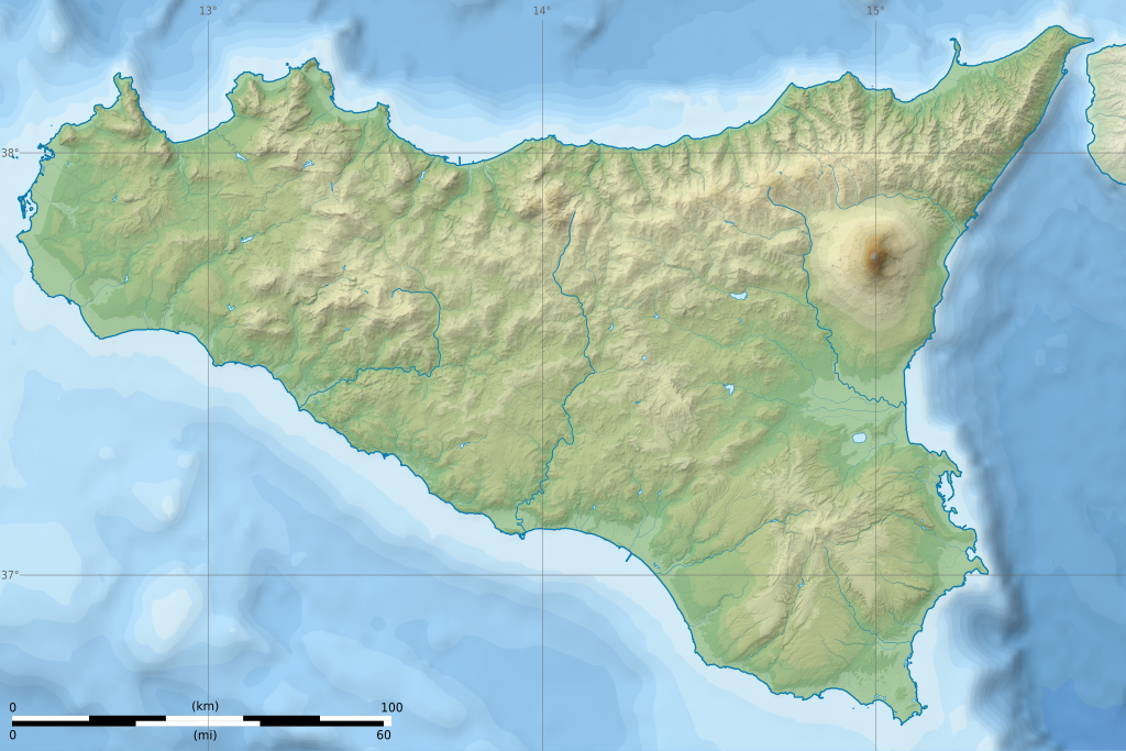
English: Topographic blank map of Sicily island, Italy.
Equirectangular projection, WGS84 datum. Geographic limits of the map: West: 012° 22.5' E, East: 015° 45' E, North: 38° 21.6' N, South: 36° 35' N. Standard meridian: 013° 45' E, True scale parallel: 37° 45' N. Français : Carte topographique de l'île de Sicile, en Italie. Projection cylindrique équidistante, système géodésique WGS84. Limites géographiques de la carte : Ouest 012° 22.5' E, Est 015° 45' E, Nord 38° 21.6' N, Sud 36° 35' N. Méridien de référence 013° 45' E, parallèle de référence 37° 45' N. |
| Datum | (UTC) |
| Fons |
English: * Topography and relief: NASA Shuttle Radar Topography Mission (SRTM3 v.2) (public domain)
Français : * Topographie et relief : NASA Shuttle Radar Topography Mission (SRTM3 v.2) (domaine public)
|
| Auctor | |
| Attributio (required by the license) | © Sémhur / Wikimedia Commons / |
| Other versions |
|
| SVG genesis |


| Object location | | View this and other nearby images on: OpenStreetMap |
|---|
Potestas usoris
I, the copyright holder of this work, hereby publish it under the following licenses:
| Copyleft: This work of art is free; you can redistribute it and/or modify it according to terms of the Free Art License. You will find a specimen of this license on the Copyleft Attitude site as well as on other sites. |
This file is licensed under the Creative Commons Attribution-Share Alike 4.0 International, 3.0 Unported, 2.5 Generic, 2.0 Generic and 1.0 Generic license.
- Tibi licet:
- communicare – copiare, distribuere et committere hoc opus
- to remix – to adapt the work
- His condicionibus:
- attributio – You must give appropriate credit, provide a link to the license, and indicate if changes were made. You may do so in any reasonable manner, but not in any way that suggests the licensor endorses you or your use.
- aequa parte – If you remix, transform, or build upon the material, you must distribute your contributions under the same or compatible license as the original.
Tibi typum permissionis ligere licet.
Historia fasciculi
Presso die vel tempore fasciculum videbis, sicut tunc temporis apparuit.
| Dies/Tempus | Minutio | Dimensiones | Usor | Sententia | |
|---|---|---|---|---|---|
| recentissima | 20:59, 22 Ianuarii 2015 | | 2 373 × 1 582 (4.66 megaocteti) | Sémhur | Trait de côte plus épais, pays ou province autre que la Sicile en blanc opacité 40% |
| 20:03, 2 Ianuarii 2015 |  | 2 373 × 1 582 (4.66 megaocteti) | Sémhur | == {{int:filedesc}} == {{Information |Description= {{en|1=Topographic blank map of Sicily island, Italy.<br>Equirectangular projection, WGS84 datum. Geographic limits of the map: West: 012° 22.5' E, East: 015° 45' E, North: 38° 21.6'... |
Nexus ad fasciculum
Ad hunc fasciculum nectit:
Usus fasciculi per inceptus Vicimediorum
Quae incepta Vici fasciculo utuntur:
- Usus in fr.wikipedia.org
- Usus in it.wikipedia.org
- Monte San Calogero (Sciacca)
- Monte Pellegrino
- Gole dell'Alcantara
- Monte Sparagio
- Monte Lauro
- Parco dell'Etna
- Monte Turcisi
- Monte Iudica
- Capo Peloro
- Grotte della Gurfa
- Rocche del Crasto
- Isola di Ortigia
- Isola Grande
- Lago di Nicito
- Monte Scuderi
- Monte Cofano
- Isola di Capo Passero
- Monte Cammarata
- Lago di Ancipa
- Pizzo Carbonara
- Monte Rossomanno
- Lago Dirillo
- Lago Trearie
- Monte Bonifato
- Capo Zafferano
- Monte Meliuso
- Capo Boeo
- Lago Maulazzo
- Lago Biviere
- Monte Soro
- Scala dei Turchi
- Monte Cuccio
- Isola Bella (Sicilia)
- Grotta del Gelo
- Capo Murro di Porco
- Isola Formica
- Serra Casale
- Etna
- Montagna Longa
- Monti Climiti
- Monte Pizzuta
- Monte Ilice
- Monte Roccelito
- Monte Arcibessi
- Monte Grifone
- Monte Billiemi
- Isola Lachea
- Colle del Contrasto
View more global usage of this file.