
Fasciculus:OttomanEmpire1801.jpg
Sua resolutio (1 638 × 1 296 elementa imaginalia, magnitudo fasciculi: 605 chiliocteti, typus MIME: image/jpeg)

Summarium
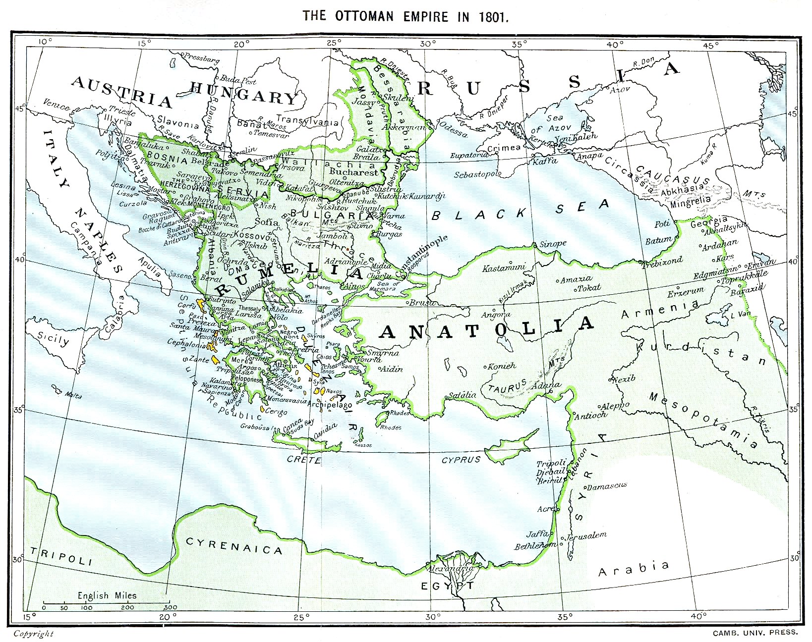
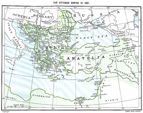
Ottoman Empire (green) and Septinsular Republic (yellow) in 1801.
Potestas usoris
|
This work is in the public domain in its country of origin and other countries and areas where the copyright term is the author's life plus 70 years or fewer.
| |
| This file has been identified as being free of known restrictions under copyright law, including all related and neighboring rights. | |
Historia fasciculi
Presso die vel tempore fasciculum videbis, sicut tunc temporis apparuit.
| Dies/Tempus | Minutio | Dimensiones | Usor | Sententia | |
|---|---|---|---|---|---|
| recentissima | 16:06, 11 Ianuarii 2023 | | 1 638 × 1 296 (605 chiliocteti) | Enyavar | Reverted to version as of 08:56, 11 March 2006 (UTC) --> even if they are wrong, don't change historical maps! |
| 17:48, 3 Februarii 2014 |  | 1 638 × 1 296 (518 chiliocteti) | Spiridon Ion Cepleanu | Some little changes according with the 1801 situation : The Septinsular Rep. includes Ionian Is., not the Cyclades, Serbia became autonomous 1817... | |
| 08:56, 11 Martii 2006 |  | 1 638 × 1 296 (605 chiliocteti) | Julo | Ottoman Empire (green) & Septinsular Republic (yellow) in 1801, on the 19th century map {{PD-old}} category:19th century mapsCategory:Historical maps of the Middle EastCategory:Historical maps of the Balkans[[Category:Historical maps of Africa |
Nexus ad fasciculum
Ad hunc fasciculum nectit:
Usus fasciculi per inceptus Vicimediorum
Quae incepta Vici fasciculo utuntur:
- Usus in azb.wikipedia.org
- Usus in ba.wikipedia.org
- Usus in el.wikipedia.org
- Usus in fr.wikipedia.org
- Usus in hy.wikipedia.org
- Usus in pl.wikipedia.org
- Usus in sq.wikipedia.org
- Usus in sv.wikipedia.org
- Usus in uk.wikipedia.org