
Fasciculus:Mayotte topographic map-fr.svg

Size of this PNG preview of this SVG file: 477 × 599 elementa imaginalia. Aliae mensurae: 191 × 240 elementa imaginalia | 382 × 480 elementa imaginalia | 612 × 768 elementa imaginalia | 815 × 1 024 elementa imaginalia | 1 631 × 2 048 elementa imaginalia | 1 033 × 1 297 elementa imaginalia.
Sua resolutio (fasciculus SVG, nominale 1 033 × 1 297 elementa imaginalia, magnitudo fasciculi: 874 chiliocteti)
Summarium
| Descriptio |
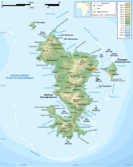
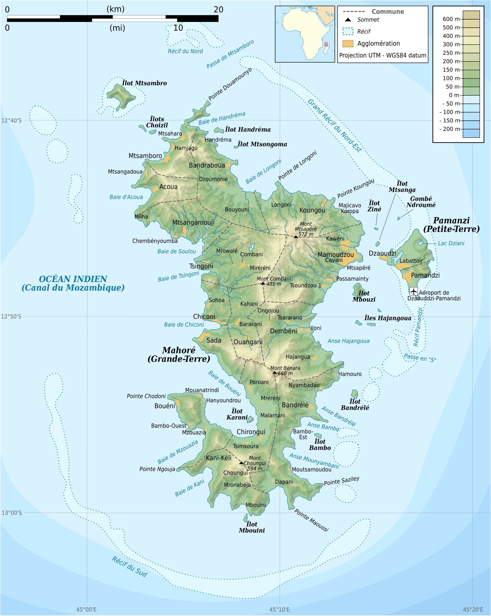
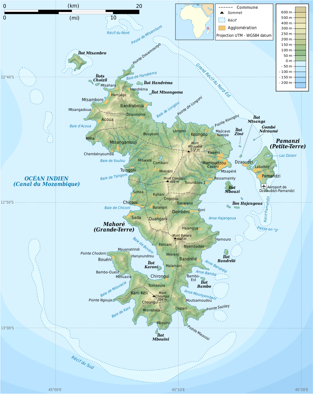
Français : Carte topographique de Mayotte en français. Utiliser la version PNG dans les articles pour un rendu plus rapide.
|
| Datum | |
| Fons |
Own work. Sources of data:
|
| Auctor | Rémi Kaupp |
| Other versions |
[]
|


English: This map has been created by Rémi Kaupp (User:Korrigan) and released under the license(s) stated below. You are free to use it for any purpose as long as you credit me and follow the terms of the license. You may need to credit the sources of data of the map (please check). Example:
Français : Cette carte a été créée par Rémi Kaupp (User:Korrigan) et placée sous la ou les licence(s) ci-dessous. Vous êtes libre de la réutiliser, tant que vous me citez en tant qu'auteur et suivez les instructions de la licence. Certaines sources de données de la carte doivent peut-être être créditées, veuillez vérifier. Exemple :
|
 |
Potestas usoris
I, the copyright holder of this work, hereby publish it under the following licenses:

|
Licet hoc documentum exscribere vel distribuere vel demutare sub GNU Liberarum Litterarum Licentiae conditionibus in editione 1.2 aut in ulla editione recentiori a Fundatione Liberarum Programmationis Partium publicata; praeterquam Sectiones Immutabiles et Verba Involucra Adversa et Aversa. Licentiae exemplar praesto est in sectione intitulata GNU Free Documentation License. |
This file is licensed under the Creative Commons Attribution-Share Alike 4.0 International, 3.0 Unported, 2.5 Generic, 2.0 Generic and 1.0 Generic license.
- Tibi licet:
- communicare – copiare, distribuere et committere hoc opus
- to remix – to adapt the work
- His condicionibus:
- attributio – You must give appropriate credit, provide a link to the license, and indicate if changes were made. You may do so in any reasonable manner, but not in any way that suggests the licensor endorses you or your use.
- aequa parte – If you remix, transform, or build upon the material, you must distribute your contributions under the same or compatible license as the original.
Tibi typum permissionis ligere licet.
Historia fasciculi
Presso die vel tempore fasciculum videbis, sicut tunc temporis apparuit.
| Dies/Tempus | Minutio | Dimensiones | Usor | Sententia | |
|---|---|---|---|---|---|
| recentissima | 20:55, 24 Martii 2009 | | 1 033 × 1 297 (874 chiliocteti) | Korrigan | {{Information |Description={{en|Topographic map of Mayotte in French. Use the PNG version in articles for faster loading.}} {{fr|Carte topographique de Mayotte en français. Utiliser [[:File:Mayotte_topographic |
Nexus ad fasciculum
Ad hunc fasciculum nectit:
Usus fasciculi per inceptus Vicimediorum
Quae incepta Vici fasciculo utuntur:
- Usus in ar.wikipedia.org
- Usus in az.wikipedia.org
- Usus in br.wikipedia.org
- Usus in ca.wikipedia.org
- Usus in ce.wikipedia.org
- Usus in cs.wikipedia.org
- Usus in en.wikipedia.org
- Usus in es.wikipedia.org
- Usus in fr.wikipedia.org
- Usus in ga.wikipedia.org
- Usus in gl.wikipedia.org
- Usus in io.wikipedia.org
- Usus in is.wikipedia.org
- Usus in it.wikipedia.org
- Usus in ja.wikipedia.org
- Usus in nl.wikipedia.org
- Usus in pl.wiktionary.org
- Usus in ru.wikipedia.org
- Usus in sc.wikipedia.org
- Usus in tt.wikipedia.org
- Usus in uk.wikipedia.org
- Usus in www.wikidata.org