
Fasciculus:Map of the Territory of the Parisii.svg

Size of this PNG preview of this SVG file: 424 × 600 elementa imaginalia. Aliae mensurae: 170 × 240 elementa imaginalia | 339 × 480 elementa imaginalia | 543 × 768 elementa imaginalia | 724 × 1 024 elementa imaginalia | 1 448 × 2 048 elementa imaginalia | 744 × 1 052 elementa imaginalia.
Sua resolutio (fasciculus SVG, nominale 744 × 1 052 elementa imaginalia, magnitudo fasciculi: 148 chiliocteti)
| Descriptio |
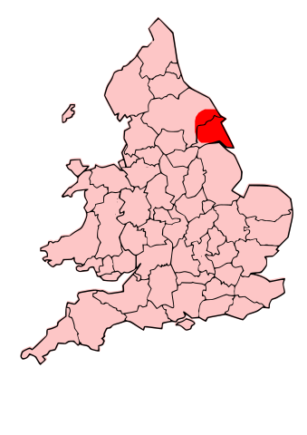
English: A map showing the territory of the Dobunni tribe overlayed in red in the context of the modern county boundaries of England and wales Image depicting the Celts of North and Midland England, pre-Roman Britain times. I created this myself, under the guidance (to find location of them) of Roman-Britain.org |
| Datum | (UTC) |
| Fons | |
| Auctor |
|
.svg)
.png)
| This is a retouched picture, which means that it has been digitally altered from its original version. Modifications: Modified county map with overlay of territory of parisii. The original can be viewed here: England Celtic tribes - North and Midlands.png:
|
This file is licensed under the Creative Commons Attribution-Share Alike 3.0 Unported license.
- Tibi licet:
- communicare – copiare, distribuere et committere hoc opus
- to remix – to adapt the work
- His condicionibus:
- attributio – You must give appropriate credit, provide a link to the license, and indicate if changes were made. You may do so in any reasonable manner, but not in any way that suggests the licensor endorses you or your use.
- aequa parte – If you remix, transform, or build upon the material, you must distribute your contributions under the same or compatible license as the original.
Original upload log
This image is a derivative work of the following images:
- File:Map_of_the_Territory_of_the_Dobunni.svg licensed with Cc-by-sa-3.0, GFDL
- 2009-10-13T19:47:34Z Jpb1301 744x1052 (151192 Bytes) {{Information |Description={{en|1=A map showing the territory of the Dobunni tribe overlayed in red in the context of the modern county boundaries of England and wales}} |Source=*[[:File:Map_of_the_Territory_of_the_Dobunni.sv
- 2009-10-13T17:38:36Z Jpb1301 744x1052 (151194 Bytes) {{Information |Description={{en|1=A map showing the territory of the Dobunni tribe overlayed in red in the context of the modern county boundaries of England and wales}} |Source=*[[:File:Map_of_the_Territory_of_the_Cornovii_(
- File:England_Celtic_tribes_-_North_and_Midlands.png licensed with Cc-by-sa-3.0
- 2009-07-29T23:43:34Z Thomas Gun 296x495 (27459 Bytes) == Summary == {{Information |Description=Image depicting the Celts of North and Midland England, pre-[[Roman Britain]] times. I created this myself, under the guidance (to find location of them) of [http://www.roman-britain.o
Uploaded with derivativeFX
Historia fasciculi
Presso die vel tempore fasciculum videbis, sicut tunc temporis apparuit.
| Dies/Tempus | Minutio | Dimensiones | Usor | Sententia | |
|---|---|---|---|---|---|
| recentissima | 20:16, 16 Octobris 2009 | | 744 × 1 052 (148 chiliocteti) | Jpb1301 | {{Information |Description={{en|1=A map showing the territory of the Dobunni tribe overlayed in red in the context of the modern county boundaries of England and wales}}Image depicting the Celts of North and Midland England, pre-Roman Britain times. I |
Nexus ad fasciculum
Ad hunc fasciculum nectit:
Usus fasciculi per inceptus Vicimediorum
Quae incepta Vici fasciculo utuntur:
- Usus in ca.wikipedia.org
- Usus in cy.wikipedia.org
- Usus in en.wikipedia.org
- Usus in fi.wikipedia.org
- Usus in fr.wikipedia.org
- Discussion:Parisii
- Parisii (Grande-Bretagne)
- Wikipédia:Statistiques des anecdotes de la page d'accueil/Visibilité des anecdotes (2020)
- Discussion:Parisii/LSV 17690
- Wikipédia:Statistiques des anecdotes de la page d'accueil/Visibilité des anecdotes (2020)/2020 02
- Projet:Aide et accueil/Twitter/Tweets/archives/février 2020
- Wikipédia:Le saviez-vous ?/Archives/2020