
Fasciculus:Manchester UK locator map.svg

Size of this PNG preview of this SVG file: 800 × 557 elementa imaginalia. Aliae mensurae: 320 × 223 elementa imaginalia | 640 × 446 elementa imaginalia | 1 024 × 714 elementa imaginalia | 1 280 × 892 elementa imaginalia | 2 560 × 1 784 elementa imaginalia | 1 425 × 993 elementa imaginalia.
Sua resolutio (fasciculus SVG, nominale 1 425 × 993 elementa imaginalia, magnitudo fasciculi: 860 chiliocteti)
| Descriptio |
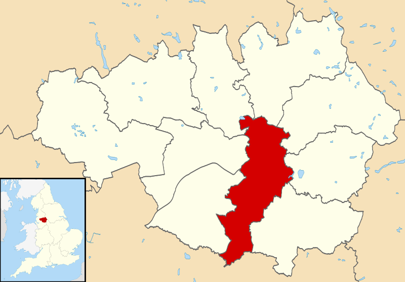
Map of Greater Manchester, UK with Manchester highlighted. Equirectangular map projection on WGS 84 datum, with N/S stretched 165% |
| Datum | |
| Fons |
|
| Auctor | Nilfanion, created using Ordnance Survey data |
| Permissio (Reusing this file) |
This file is licensed under the Creative Commons Attribution-Share Alike 3.0 Unported license. Attributio: Contains Ordnance Survey data © Crown copyright and database right
|
Historia fasciculi
Presso die vel tempore fasciculum videbis, sicut tunc temporis apparuit.
| Dies/Tempus | Minutio | Dimensiones | Usor | Sententia | |
|---|---|---|---|---|---|
| recentissima | 09:44, 14 Aprilis 2011 | | 1 425 × 993 (860 chiliocteti) | Nilfanion | {{Information |Description=Map of Greater Manchester, UK with Manchester highlighted. Equirectangular map projection on WGS 84 datum, with N/S stretched 165% |Source=Ordnance Survey [https:/ |
Nexus ad fasciculum
Ad hunc fasciculum nectit:
Usus fasciculi per inceptus Vicimediorum
Quae incepta Vici fasciculo utuntur:
- Usus in ar.wikipedia.org
- Usus in arz.wikipedia.org
- Usus in ast.wikipedia.org
- Usus in azb.wikipedia.org
- Usus in bn.wikipedia.org
- Usus in ca.wikipedia.org
- Usus in cs.wikipedia.org
- Usus in cy.wikipedia.org
- Usus in diq.wikipedia.org
- Usus in el.wikipedia.org
- Usus in en.wikipedia.org
- Usus in en.wikivoyage.org
- Usus in eo.wikinews.org
- Usus in eu.wikipedia.org
- Usus in fa.wikipedia.org
- Usus in fi.wikipedia.org
- Usus in fr.wikipedia.org
- Usus in ga.wikipedia.org
- Usus in gl.wikipedia.org
- Usus in ha.wikipedia.org
- Usus in hi.wikipedia.org
- Usus in ia.wikipedia.org
- Usus in id.wikipedia.org
- Usus in ie.wikipedia.org
- Usus in incubator.wikimedia.org
- Usus in ja.wikipedia.org
- Usus in kab.wikipedia.org
- Usus in ko.wikipedia.org
- Usus in ml.wikipedia.org
- Usus in mn.wikipedia.org
- Usus in mr.wikipedia.org
- Usus in mzn.wikipedia.org
- Usus in ne.wikipedia.org
- Usus in oc.wikipedia.org
- Usus in ps.wikipedia.org
- Usus in sco.wikipedia.org
- Usus in simple.wikipedia.org
- Usus in sv.wikipedia.org
- Usus in th.wikipedia.org
- Usus in ur.wikipedia.org
- Usus in vi.wikipedia.org
- Usus in vo.wikipedia.org
- Usus in www.wikidata.org
View more global usage of this file.