
Fasciculus:Kenya location map.svg

Size of this PNG preview of this SVG file: 545 × 600 elementa imaginalia. Aliae mensurae: 218 × 240 elementa imaginalia | 436 × 480 elementa imaginalia | 698 × 768 elementa imaginalia | 931 × 1 024 elementa imaginalia | 1 862 × 2 048 elementa imaginalia | 1 000 × 1 100 elementa imaginalia.
Sua resolutio (fasciculus SVG, nominale 1 000 × 1 100 elementa imaginalia, magnitudo fasciculi: 329 chiliocteti)
Summarium
| Descriptio |
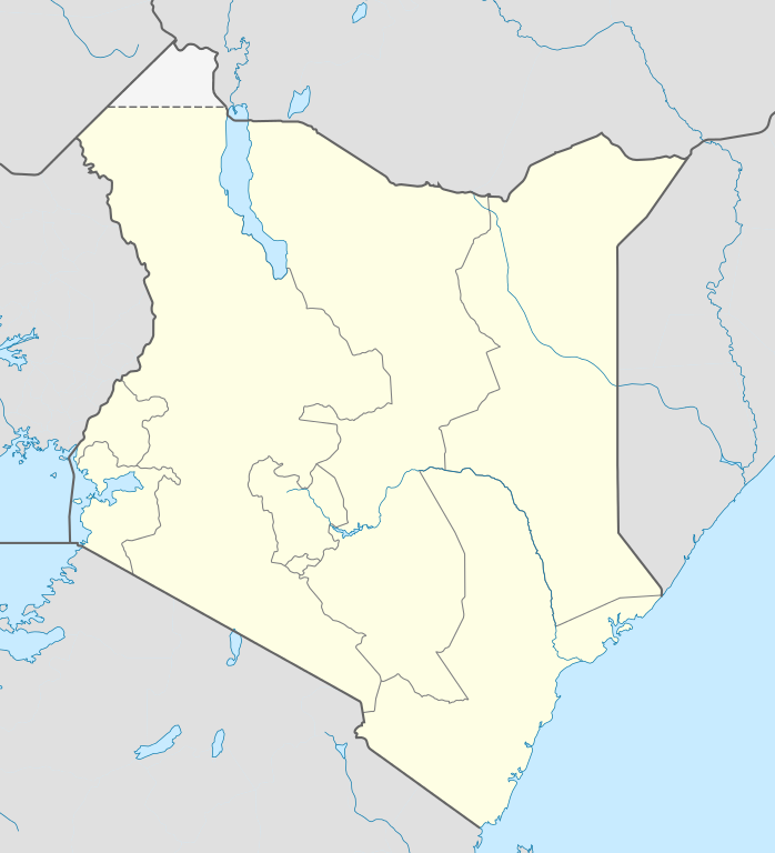
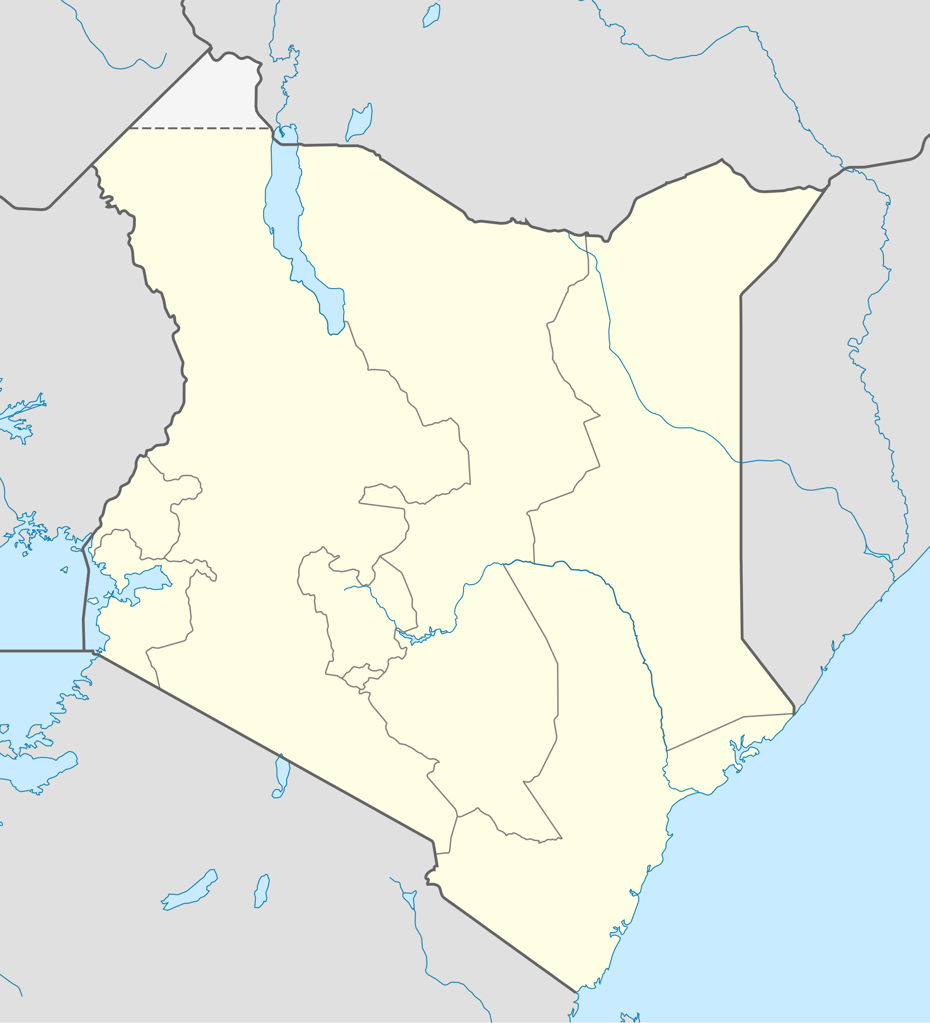
Deutsch: Location map of Kenya
Equirectangular projection. Strechted by 100.0%. Geographic limits of the map:
|
| Datum | |
| Fons | Opus proprium |
| Auctor | Uwe Dedering |
| Other versions |
|

Potestas usoris
Uwe Dedering at Germanica Vicipaedia, the copyright holder of this work, hereby publishes it under the following licenses:

|
Licet hoc documentum exscribere vel distribuere vel demutare sub GNU Liberarum Litterarum Licentiae conditionibus in editione 1.2 aut in ulla editione recentiori a Fundatione Liberarum Programmationis Partium publicata; praeterquam Sectiones Immutabiles et Verba Involucra Adversa et Aversa. Licentiae exemplar praesto est in sectione intitulata GNU Free Documentation License. |
This file is licensed under the Creative Commons Attribution-Share Alike 3.0 Unported license.
Attributio: Uwe Dedering at Germanica Vicipaedia
- Tibi licet:
- communicare – copiare, distribuere et committere hoc opus
- to remix – to adapt the work
- His condicionibus:
- attributio – You must give appropriate credit, provide a link to the license, and indicate if changes were made. You may do so in any reasonable manner, but not in any way that suggests the licensor endorses you or your use.
- aequa parte – If you remix, transform, or build upon the material, you must distribute your contributions under the same or compatible license as the original.
This file is licensed under the Creative Commons Attribution-Share Alike 3.0 Germany license.
Attributio: Uwe Dedering at Germanica Vicipaedia
- Tibi licet:
- communicare – copiare, distribuere et committere hoc opus
- to remix – to adapt the work
- His condicionibus:
- attributio – You must give appropriate credit, provide a link to the license, and indicate if changes were made. You may do so in any reasonable manner, but not in any way that suggests the licensor endorses you or your use.
- aequa parte – If you remix, transform, or build upon the material, you must distribute your contributions under the same or compatible license as the original.

Tibi typum permissionis ligere licet.
Original upload log
Transferred from de.wikipedia to Commons by Uwe Dedering.
The original description page was here. All following user names refer to de.wikipedia.
- 2010-02-16 11:08 Uwe Dedering 1000×1200× (349329 bytes) {{Information |Beschreibung = Location map of Kenya Equirectangular projection. Strechted by 100.0%. Geographic limits of the map: * N: 7.0° N * S: -5.0° N * W: 33.0° E * E: 43.0° E Made with Natural Earth. Free vector and raster map data @ naturalearthdata.com. |Quelle = own work |Urheber = [[Benutzer:Uwe Dedering|Uwe Dedering]] |Datum = 20100216 |Genehmigung = |Andere Versionen = |Anmerkungen = }}
Historia fasciculi
Presso die vel tempore fasciculum videbis, sicut tunc temporis apparuit.
| Dies/Tempus | Minutio | Dimensiones | Usor | Sententia | |
|---|---|---|---|---|---|
| recentissima | 12:00, 17 Februarii 2010 | | 1 000 × 1 100 (329 chiliocteti) | Uwe Dedering | regional boundaries only for kenya |
| 11:37, 17 Februarii 2010 |  | 1 000 × 1 100 (368 chiliocteti) | Uwe Dedering | Northern limit now 6 degrees | |
| 21:52, 16 Februarii 2010 |  | 1 000 × 1 200 (341 chiliocteti) | Uwe Dedering | {{Information |Description={{de|Location map of Kenya Equirectangular projection. Strechted by 100.0%. Geographic limits of the map: * N: 7.0° N * S: -5.0° N * W: 33.0° E * E: 43.0° E Made with Natural Earth. Free vector and raster map data @ naturale |
Nexus ad fasciculum
Ad hunc fasciculum nectunt:
Usus fasciculi per inceptus Vicimediorum
Quae incepta Vici fasciculo utuntur:
- Usus in af.wikipedia.org
- Usus in als.wikipedia.org
- Usus in am.wikipedia.org
- Usus in ar.wikipedia.org
- Usus in arz.wikipedia.org
- Usus in az.wikipedia.org
- Usus in ba.wikipedia.org
- Usus in be-tarask.wikipedia.org
- Usus in be.wikipedia.org
- Usus in bg.wikipedia.org
- Usus in bn.wikipedia.org
- Usus in ceb.wikipedia.org
View more global usage of this file.