
Fasciculus:Karte Ephesos MKL1888.png
Nulla maior resolutio exstat.
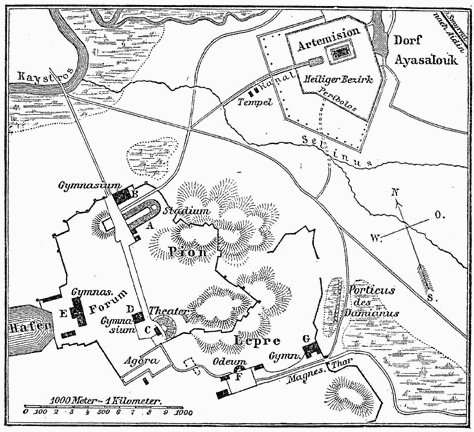
Karte_Ephesos_MKL1888.png (474 × 432 elementa imaginalia, magnitudo fasciculi: 41 chiliocteti, typus MIME: image/png)
Summarium
| Descriptio | |
| Datum | |
| Fons | Encyclopedia: Meyers Konversationslexikon (MKL) |
| Auctor | MKL cartographers |
Potestas usoris
| This image comes from the 4th edition of Meyers Konversationslexikon (1885–90). The copyrights have expired and this image is in the public domain. |
|
This work is in the public domain in its country of origin and other countries and areas where the copyright term is the author's life plus 100 years or fewer. This work is in the public domain in the United States because it was published (or registered with the U.S. Copyright Office) before January 1, 1929. | |
| This file has been identified as being free of known restrictions under copyright law, including all related and neighboring rights. | |
Historia fasciculi
Presso die vel tempore fasciculum videbis, sicut tunc temporis apparuit.
| Dies/Tempus | Minutio | Dimensiones | Usor | Sententia | |
|---|---|---|---|---|---|
| recentissima | 18:07, 12 Decembris 2004 | | 474 × 432 (41 chiliocteti) | ¡0-8-15! | {{PD-Meyers}} |
Nexus ad fasciculum
Ad hunc fasciculum nectit:
Usus fasciculi per inceptus Vicimediorum
Quae incepta Vici fasciculo utuntur:
- Usus in ar.wikipedia.org
- Usus in be-tarask.wikipedia.org
- Usus in be.wikipedia.org
- Usus in bg.wikipedia.org
- Usus in ca.wikipedia.org
- Usus in cs.wikipedia.org
- Usus in da.wikipedia.org
- Usus in de.wikipedia.org
- Usus in en.wikipedia.org
- Usus in es.wikipedia.org
- Usus in fr.wikipedia.org
- Usus in gl.wikipedia.org
- Usus in hi.wikipedia.org
- Usus in hr.wikipedia.org
- Usus in hy.wikipedia.org
- Usus in it.wikipedia.org
- Usus in it.wikivoyage.org
- Usus in jv.wikipedia.org
- Usus in mk.wikipedia.org
- Usus in mr.wikipedia.org
- Usus in mt.wikipedia.org
- Usus in ru.wikipedia.org
- Usus in sl.wikipedia.org
- Usus in stq.wikipedia.org
- Usus in sw.wikipedia.org
- Usus in uk.wikipedia.org
- Usus in vi.wikipedia.org