
Fasciculus:Europe countries map local lang 2.png
Mensura huius perspectionis: 737 × 600 elementa imaginalia. Aliae mensurae: 295 × 240 elementa imaginalia | 590 × 480 elementa imaginalia | 944 × 768 elementa imaginalia | 1 259 × 1 024 elementa imaginalia | 1 475 × 1 200 elementa imaginalia.
Sua resolutio (1 475 × 1 200 elementa imaginalia, magnitudo fasciculi: 837 chiliocteti, typus MIME: image/png)
Summarium
| Descriptio |
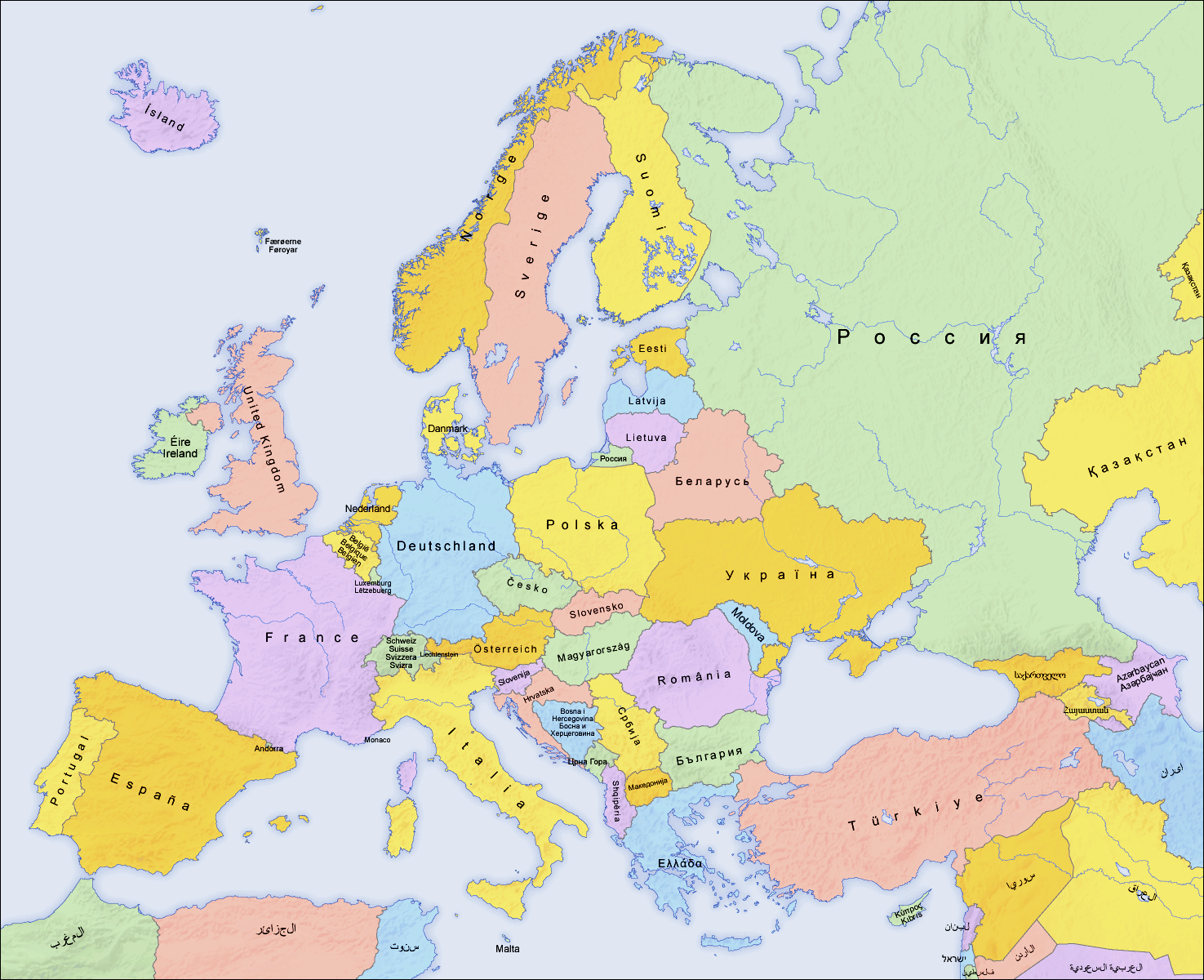
English: Map of countries in Europe and the surrounding region |
||||||||||
| Datum | 02.04.2006 | ||||||||||
| Fons | derivative work of Europe countries map local lang.png by San Jose, based on the Generic Mapping Tools and ETOPO2 | ||||||||||
| Auctor | San Jose (map), Hayden120 (retouch) | ||||||||||
| Permissio (Reusing this file) |
|
||||||||||
| Other versions |
[]
|


| This is a retouched picture, which means that it has been digitally altered from its original version. Modifications: Saturation, brightness, contrast. The original can be viewed here: Europe countries map local lang.png:
|
See also
_en.png)
.png)
.jpg)
Historia fasciculi
Presso die vel tempore fasciculum videbis, sicut tunc temporis apparuit.
| Dies/Tempus | Minutio | Dimensiones | Usor | Sententia | |
|---|---|---|---|---|---|
| recentissima | 07:59, 11 Septembris 2009 | | 1 475 × 1 200 (837 chiliocteti) | Hayden120 | == {{int:filedesc}} == {{Information |Description= {{en|Map of countries in Europe}} |Source=derivative work of Europe countries map local lang.png by San Jose, based on the [http://gmt.soest |
Nexus ad fasciculum
Ad hunc fasciculum nectit:
Usus fasciculi per inceptus Vicimediorum
Quae incepta Vici fasciculo utuntur:
- Usus in de.wikipedia.org
- Usus in de.wiktionary.org
- Usus in nl.wikipedia.org
- Usus in ro.wikipedia.org
- Usus in ru.wikipedia.org