
Fasciculus:Dominican Republic relief location map.jpg

Mensura huius perspectionis: 737 × 599 elementa imaginalia. Aliae mensurae: 295 × 240 elementa imaginalia | 590 × 480 elementa imaginalia | 945 × 768 elementa imaginalia | 1 259 × 1 024 elementa imaginalia | 1 338 × 1 088 elementa imaginalia.
Sua resolutio (1 338 × 1 088 elementa imaginalia, magnitudo fasciculi: 403 chiliocteti, typus MIME: image/jpeg)
Summarium
| Descriptio |
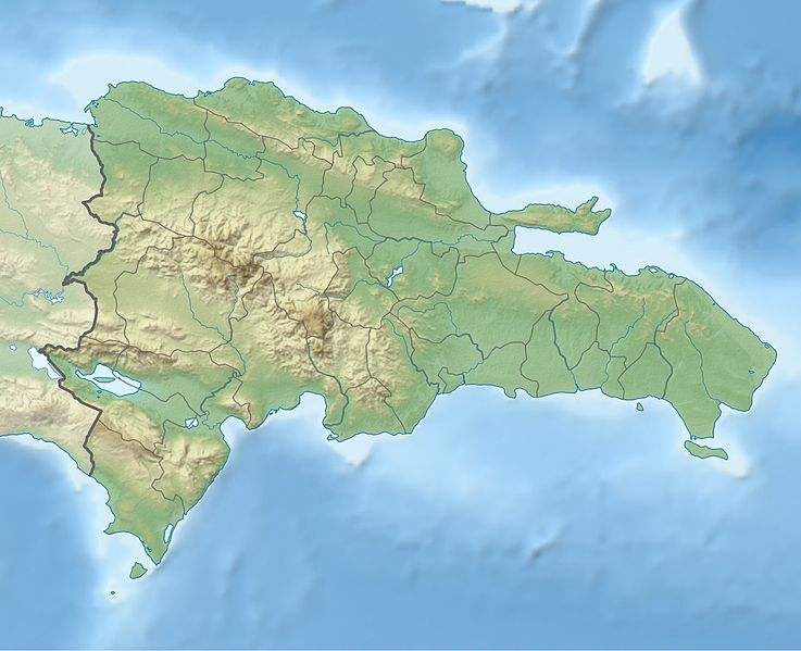
Deutsch: Physische Positionskarte Dominikanische Republik mit Provinzen, Quadratische Plattkarte, N-S-Streckung 105 %. Geographische Begrenzung der Karte:
English: Physical Location map Dominican Republic with Provinces, Equirectangular projection, N/S stretching 105 %. Geographic limits of the map:
|
||
| Datum | |||
| Fons | Opus proprium, SRTM3, ETOPO1, VMAP0, http://www.one.gob.do, http://lib.utexas.edu/maps/dominican_republic.html | ||
| Auctor | Alexrk2 | ||
| Other versions |
|
||
| JPG genesis |
|


Potestas usoris
I, the copyright holder of this work, hereby publish it under the following license:
This file is licensed under the Creative Commons Attribution-Share Alike 3.0 Unported license.
- Tibi licet:
- communicare – copiare, distribuere et committere hoc opus
- to remix – to adapt the work
- His condicionibus:
- attributio – You must give appropriate credit, provide a link to the license, and indicate if changes were made. You may do so in any reasonable manner, but not in any way that suggests the licensor endorses you or your use.
- aequa parte – If you remix, transform, or build upon the material, you must distribute your contributions under the same or compatible license as the original.
Historia fasciculi
Presso die vel tempore fasciculum videbis, sicut tunc temporis apparuit.
| Dies/Tempus | Minutio | Dimensiones | Usor | Sententia | |
|---|---|---|---|---|---|
| recentissima | 17:36, 8 Februarii 2010 | | 1 338 × 1 088 (403 chiliocteti) | Alexrk2 | == Summary == {{Information |Description= {{de|Physische Positionskarte Dominikanische Republik mit Provinzen, Quadratische Plattkarte, N-S-Streckung 105 %. Geographische Begrenzung der Karte:}} {{en|Physical Location map |
Nexus ad fasciculum
Ad hunc fasciculum nectit:
Usus fasciculi per inceptus Vicimediorum
Quae incepta Vici fasciculo utuntur:
- Usus in af.wikipedia.org
- Usus in ar.wikipedia.org
- Usus in ast.wikipedia.org
- Usus in az.wikipedia.org
- Usus in ba.wikipedia.org
- Usus in be.wikipedia.org
- Usus in bg.wikipedia.org
- Usus in bn.wikipedia.org
- Usus in bs.wikipedia.org
- Usus in ca.wikipedia.org
- Usus in ceb.wikipedia.org
- Usus in ce.wikipedia.org
- Usus in ckb.wikipedia.org
- Usus in cs.wikipedia.org
- Usus in da.wikipedia.org
- Usus in de.wikipedia.org
View more global usage of this file.