
Fasciculus:Diyarbakirwalls2.jpg
Mensura huius perspectionis: 800 × 516 elementa imaginalia. Aliae mensurae: 320 × 207 elementa imaginalia | 640 × 413 elementa imaginalia | 894 × 577 elementa imaginalia.
Sua resolutio (894 × 577 elementa imaginalia, magnitudo fasciculi: 618 chiliocteti, typus MIME: image/jpeg)
| Descriptio |
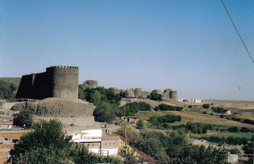
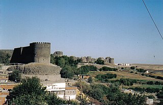
English: The city walls of Diyarbakir in Southeastern Turkey stretch almost unbroken for 6 kilometres. The current walls were built by Constantius II when the city was called Roman "Amida", and extended by Valentinian I between 367-375 AD. |
||||||||
| Datum | circa 2003 | ||||||||
| Fons | (C) Gerry Lynch, 2003. | ||||||||
| Auctor | (C) Gerry Lynch, 2003. | ||||||||
| Permissio (Reusing this file) |
I, the copyright holder of this work, hereby publish it under the following licenses:
Tibi typum permissionis ligere licet. |

| Camera location | | View this and other nearby images on: OpenStreetMap |
|---|
Historia fasciculi
Presso die vel tempore fasciculum videbis, sicut tunc temporis apparuit.
| Dies/Tempus | Minutio | Dimensiones | Usor | Sententia | |
|---|---|---|---|---|---|
| recentissima | 12:28, 21 Iulii 2011 | | 894 × 577 (618 chiliocteti) | Citypeek | refocus with Gimp and removal border |
| 00:19, 25 Augusti 2005 |  | 900 × 577 (225 chiliocteti) | Gerry Lynch~commonswiki | The city walls of Diyarbakir in Southeastern Turkey stretch unbroken for 6 kilometres. The current walls probably date from early Byzantine times. (C) Gerry Lynch, 2003. {{GFDL}} |
Nexus ad fasciculum
Ad hunc fasciculum nectit:
Usus fasciculi per inceptus Vicimediorum
Quae incepta Vici fasciculo utuntur:
- Usus in ar.wikipedia.org
- Usus in azb.wikipedia.org
- Usus in az.wikipedia.org
- Usus in br.wikipedia.org
- Usus in ca.wikipedia.org
- Usus in ckb.wikipedia.org
- Usus in cy.wikipedia.org
- Usus in de.wikipedia.org
- Usus in de.wikivoyage.org
- Usus in el.wikipedia.org
- Usus in en.wikipedia.org
- Usus in eo.wikipedia.org
- Usus in es.wikipedia.org
- Usus in fa.wikipedia.org
- Usus in fa.wikivoyage.org
- Usus in hr.wikipedia.org
- Usus in hy.wikipedia.org
- Usus in id.wikipedia.org
- Usus in incubator.wikimedia.org
- Usus in it.wikipedia.org
- Usus in it.wikinews.org
- Usus in ka.wikipedia.org
View more global usage of this file.