
Fasciculus:Chapelle ND de Port-Blanc.jpg

Mensura huius perspectionis: 800 × 533 elementa imaginalia. Aliae mensurae: 320 × 213 elementa imaginalia | 640 × 427 elementa imaginalia.
Sua resolutio (900 × 600 elementa imaginalia, magnitudo fasciculi: 253 chiliocteti, typus MIME: image/jpeg)
|
This building is indexed in the base Mérimée, a database of architectural heritage maintained by the French Ministry of Culture, under the reference PA00089372
|
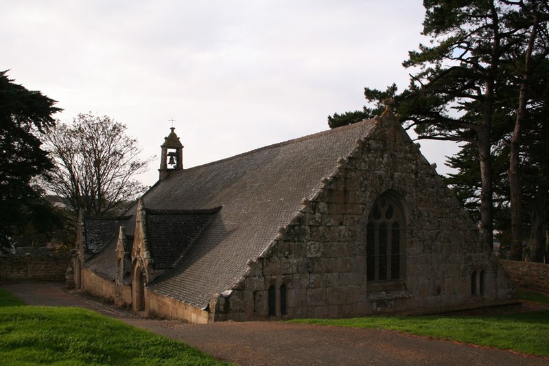
| Descriptio | la chapelle Notre-Dame de Port-Blanc à demi enterrée date du 16ème siècle. Elle est bâtie sur les fondations d’une tour de guet du 13ème siècle sur la commune de Penvénan dans les Côtes-d'Armor. | ||
| Datum | |||
| Fons | flickr | ||
| Auctor | timtom.ch | ||
| Permissio (Reusing this file) |
This file is licensed under the Creative Commons Attribution-Share Alike 2.0 Generic license.
|
| Object location | | View this and other nearby images on: OpenStreetMap |
|---|
Historia fasciculi
Presso die vel tempore fasciculum videbis, sicut tunc temporis apparuit.
| Dies/Tempus | Minutio | Dimensiones | Usor | Sententia | |
|---|---|---|---|---|---|
| recentissima | 14:42, 18 Martii 2007 | | 900 × 600 (253 chiliocteti) | Brieg | {{Information |Description= la '''chapelle Notre-Dame de Port-Blanc''' à demi enterrée date du 16ème siècle. Elle est bâtie sur les fondations d’une tour de guet du 13ème siècle sur la commune de Penvénan dans les [[:fr:Côtes- |
Nexus ad fasciculum
Ad hunc fasciculum nectit:
Usus fasciculi per inceptus Vicimediorum
Quae incepta Vici fasciculo utuntur:
- Usus in br.wikipedia.org
- Usus in de.wikipedia.org
- Usus in es.wikipedia.org
- Usus in fr.wikipedia.org
- Usus in ja.wikipedia.org
- Usus in ms.wikipedia.org
- Usus in sv.wikipedia.org
- Usus in vi.wikipedia.org
- Usus in www.wikidata.org