
Fasciculus:Caspian Sea relief location map.jpg

Mensura huius perspectionis: 301 × 600 elementa imaginalia. Aliae mensurae: 120 × 240 elementa imaginalia | 241 × 480 elementa imaginalia | 900 × 1 794 elementa imaginalia.
Sua resolutio (900 × 1 794 elementa imaginalia, magnitudo fasciculi: 771 chiliocteti, typus MIME: image/jpeg)
Summarium
| Descriptio |
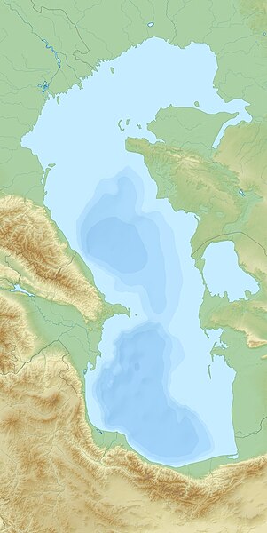
English: Relief Location map of Caspian_Sea.
|
| Datum | |
| Fons | Opus proprium |
| Auctor | Uwe Dedering |
Potestas usoris
I, the copyright holder of this work, hereby publish it under the following licenses:
This file is licensed under the Creative Commons Attribution-Share Alike 3.0 Unported license.
- Tibi licet:
- communicare – copiare, distribuere et committere hoc opus
- to remix – to adapt the work
- His condicionibus:
- attributio – You must give appropriate credit, provide a link to the license, and indicate if changes were made. You may do so in any reasonable manner, but not in any way that suggests the licensor endorses you or your use.
- aequa parte – If you remix, transform, or build upon the material, you must distribute your contributions under the same or compatible license as the original.

|
Licet hoc documentum exscribere vel distribuere vel demutare sub GNU Liberarum Litterarum Licentiae conditionibus in editione 1.2 aut in ulla editione recentiori a Fundatione Liberarum Programmationis Partium publicata; praeterquam Sectiones Immutabiles et Verba Involucra Adversa et Aversa. Licentiae exemplar praesto est in sectione intitulata GNU Free Documentation License. |
Tibi typum permissionis ligere licet.
Historia fasciculi
Presso die vel tempore fasciculum videbis, sicut tunc temporis apparuit.
| Dies/Tempus | Minutio | Dimensiones | Usor | Sententia | |
|---|---|---|---|---|---|
| recentissima | 13:59, 16 Ianuarii 2011 | | 900 × 1 794 (771 chiliocteti) | Uwe Dedering | more sea |
| 15:22, 26 Novembris 2010 |  | 900 × 1 794 (968 chiliocteti) | Uwe Dedering | {{Information |Description={{en|1= Relief Location map of Caspian_Sea. * Projection: Equirectangular projection, strechted by 138.0%. * Geographic limits of the map: :* N: 48.0° N :* S: 35.0° N :* W: 46.0° E :* E: 55.0° E * Projection center: :* NS: 4 |
Nexus ad fasciculum
Ad hunc fasciculum nectit:
Usus fasciculi per inceptus Vicimediorum
Quae incepta Vici fasciculo utuntur:
- Usus in alt.wikipedia.org
- Usus in ar.wikipedia.org
- Usus in av.wikipedia.org
- Usus in azb.wikipedia.org
- Usus in az.wikipedia.org
- Xəzər dənizi
- Abşeron yarımadası
- Bakı buxtası
- Azəri–Çıraq–Günəşli
- Abşeron arxipelaqı
- Bakı arxipelaqı
- Şahdəniz
- Şablon:Yer xəritəsi Xəzər dənizi
- Qızılağac körfəzi
- Aşur ada
- Daş adalar qövsü
- Sualtı adaları
- Abşeron körfəzi
- Spirkin Oseredok
- Janbay
- Durnev
- Böyük Setnoy
- Züdev
- Yuxarı Oseredok
- Oğurca
- Batkaçnıy
- Tülen adaları
- Çistaya Banka
- Kiçik Setnoy
- Morskoy Setnoy
- Kulalı
- Manqışlaq körfəzi
- Qaraboğazgöl
- Qızılyar körfəzi
- Aqraxan yarımadası
- Tüleniy
- Böyük Peşnıye adaları
- Türkmənbaşı körfəzi
- Şimali Çələkən körfəzi
- Türkmən körfəzi
- Cənubi Çələkən körfəzi
- Uzunada körfəzi
- Balxan körfəzi
- Astrabad körfəzi
- Qazax körfəzi
- Kaydak körfəzi
- Myortvıy Kultuk körfəzi
- Nijnıy adası
- Lixaçev adası
View more global usage of this file.