
Fasciculus:Nigeria location map.svg

Size of this PNG preview of this SVG file: 779 × 599 elementa imaginalia. Aliae mensurae: 312 × 240 elementa imaginalia | 624 × 480 elementa imaginalia | 998 × 768 elementa imaginalia | 1 280 × 985 elementa imaginalia | 2 560 × 1 970 elementa imaginalia | 954 × 734 elementa imaginalia.
Sua resolutio (fasciculus SVG, nominale 954 × 734 elementa imaginalia, magnitudo fasciculi: 442 chiliocteti)
Location of Asare, Kalambaina and
Summarium
| Descriptio |
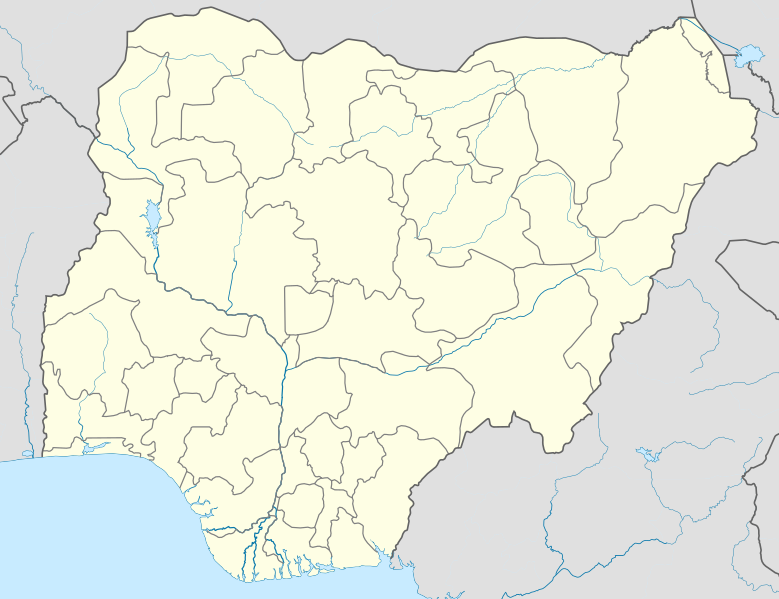
Deutsch: Positionskarte von Nigeria
Quadratische Plattkarte. Geographische Begrenzung der Karte:
English: Location map of Nigeria
Equirectangular projection. Geographic limits of the map:
|
| Datum | |
| Fons | Opus proprium (Original text: Own work, using UN-map of Nigeria No. 4228 from October 2004) |
| Auctor | Uwe Dedering |
| SVG genesis |
Potestas usoris
Uwe Dedering at Germanica Vicipaedia, the copyright holder of this work, hereby publishes it under the following licenses:

|
Licet hoc documentum exscribere vel distribuere vel demutare sub GNU Liberarum Litterarum Licentiae conditionibus in editione 1.2 aut in ulla editione recentiori a Fundatione Liberarum Programmationis Partium publicata; praeterquam Sectiones Immutabiles et Verba Involucra Adversa et Aversa. Licentiae exemplar praesto est in sectione intitulata GNU Free Documentation License. |
This file is licensed under the Creative Commons Attribution 3.0 Unported license.
Attributio: Uwe Dedering at Germanica Vicipaedia
- Tibi licet:
- communicare – copiare, distribuere et committere hoc opus
- to remix – to adapt the work
- His condicionibus:
- attributio – You must give appropriate credit, provide a link to the license, and indicate if changes were made. You may do so in any reasonable manner, but not in any way that suggests the licensor endorses you or your use.
Tibi typum permissionis ligere licet.
This file is licensed under the Creative Commons Attribution-Share Alike 3.0 Germany license.
- Tibi licet:
- communicare – copiare, distribuere et committere hoc opus
- to remix – to adapt the work
- His condicionibus:
- attributio – You must give appropriate credit, provide a link to the license, and indicate if changes were made. You may do so in any reasonable manner, but not in any way that suggests the licensor endorses you or your use.
- aequa parte – If you remix, transform, or build upon the material, you must distribute your contributions under the same or compatible license as the original.

Original upload log
Transferred from de.wikipedia to Commons by Uwe Dedering.
The original description page was here. All following user names refer to de.wikipedia.
- 2010-02-10 11:43 Uwe Dedering 954×736× (181926 bytes) better coastline
- 2010-02-10 10:39 Uwe Dedering 954×736× (181888 bytes) some little mask errors
- 2010-02-09 18:24 Uwe Dedering 954×736× (184458 bytes) clipping does not work
- 2010-02-09 14:16 Uwe Dedering 990×765× (150899 bytes) {{Information |Beschreibung = |Quelle = |Urheber = |Datum = |Genehmigung = |Andere Versionen = |Anmerkungen = Tschad-See verändert }}
- 2010-02-09 12:51 Uwe Dedering 990×765× (148360 bytes) {{Information |Beschreibung = Deutsch: Positionskarte von Nigeria Quadratische Plattkarte. Geographische Begrenzung der Karte: * N: 14° N * S: 4° N * W: 2° O * O: 15° O English: Location map of Nigeria Equirectangular projection.
Historia fasciculi
Presso die vel tempore fasciculum videbis, sicut tunc temporis apparuit.
| Dies/Tempus | Minutio | Dimensiones | Usor | Sententia | |
|---|---|---|---|---|---|
| recentissima | 14:57, 9 Decembris 2010 | | 954 × 734 (442 chiliocteti) | Uwe Dedering | better admin1 borders, less rivers |
| 20:55, 11 Februarii 2010 |  | 954 × 736 (182 chiliocteti) | Uwe Dedering | reeeeeally little corrections | |
| 12:56, 10 Februarii 2010 |  | 954 × 736 (178 chiliocteti) | Uwe Dedering | {{Information |Description={{de|Deutsch: Positionskarte von Nigeria Quadratische Plattkarte. Geographische Begrenzung der Karte: * N: 14° N * S: 4° N * W: 2° O * O: 15° O English: Location map of Nigeria Equirectangular projection. Geographic limits o |
Nexus ad fasciculum
Ad hunc fasciculum nectit:
Usus fasciculi per inceptus Vicimediorum
Quae incepta Vici fasciculo utuntur:
- Usus in af.wikipedia.org
- Usus in als.wikipedia.org
- Usus in am.wikipedia.org
- Usus in an.wikipedia.org
- Usus in ar.wikipedia.org
- Usus in ast.wikipedia.org
- Usus in azb.wikipedia.org
View more global usage of this file.