
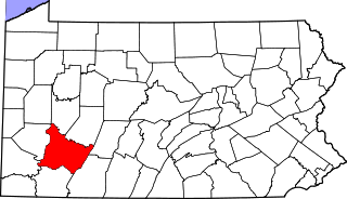
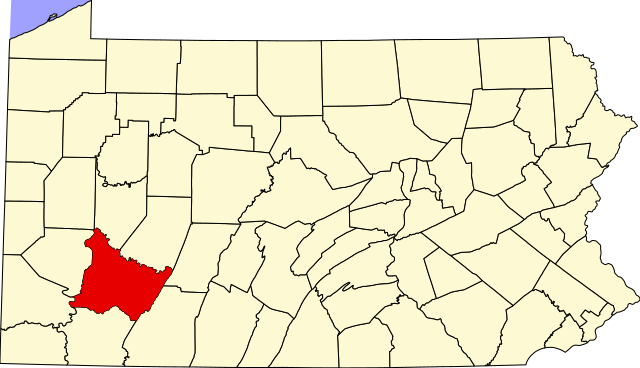
Fasciculus:Map of Pennsylvania highlighting Westmoreland County.svg

Size of this PNG preview of this SVG file: 800 × 460 elementa imaginalia. Aliae mensurae: 320 × 184 elementa imaginalia | 640 × 368 elementa imaginalia | 1 024 × 589 elementa imaginalia | 1 280 × 736 elementa imaginalia | 2 560 × 1 472 elementa imaginalia | 4 950 × 2 846 elementa imaginalia.
Sua resolutio (fasciculus SVG, nominale 4 950 × 2 846 elementa imaginalia, magnitudo fasciculi: 106 chiliocteti)
Summarium
| Descriptio |
|
| Datum | 12 Februarius 2006 (original upload date) |
| Fons | No machine-readable source provided. Own work assumed (based on copyright claims). |
| Auctor | No machine-readable author provided. David Benbennick assumed (based on copyright claims). |
| SVG genesis |
Potestas usoris
| I, the copyright holder of this work, release this work into the public domain. This applies worldwide. In some countries this may not be legally possible; if so: I grant anyone the right to use this work for any purpose, without any conditions, unless such conditions are required by law. |
Historia fasciculi
Presso die vel tempore fasciculum videbis, sicut tunc temporis apparuit.
| Dies/Tempus | Minutio | Dimensiones | Usor | Sententia | |
|---|---|---|---|---|---|
| recentissima | 16:23, 12 Februarii 2006 | | 4 950 × 2 846 (106 chiliocteti) | David Benbennick | {{subst:User:Dbenbenn/clm|county=Westmoreland County|state=Pennsylvania|type=county}} |
Nexus ad fasciculum
Ad hunc fasciculum nectit:
Usus fasciculi per inceptus Vicimediorum
Quae incepta Vici fasciculo utuntur:
- Usus in ar.wikipedia.org
- مقاطعة ويستمورلاند (بنسيلفانيا)
- أرنولد
- غرينسبورج
- جانيت
- لاتروب
- لور بوريل
- نيو كنسينغتون
- فاندرغريفت (بنسيلفانيا)
- قالب:مقاطعة ويستمورلاند (بنسيلفانيا)
- سميثتون (بنسيلفانيا)
- هونكر (بنسيلفانيا)
- يونغوود (بنسيلفانيا)
- آدامزبرغ (بنسيلفانيا)
- بن (بنسيلفانيا)
- أوكلاهوما (بنسيلفانيا)
- أفونمور (بنسيلفانيا)
- مسار الخمس نجوم
- Usus in bg.wikipedia.org
- Usus in bpy.wikipedia.org
- Usus in cdo.wikipedia.org
- Usus in ceb.wikipedia.org
- Usus in cy.wikipedia.org
- Usus in de.wikipedia.org
- Usus in en.wikipedia.org
- Latrobe, Pennsylvania
- List of counties in Pennsylvania
- Westmoreland County, Pennsylvania
- Adamsburg, Pennsylvania
- Allegheny Township, Westmoreland County, Pennsylvania
- Arnold, Pennsylvania
- Arona, Pennsylvania
- Avonmore, Pennsylvania
- Bell Township, Westmoreland County, Pennsylvania
- Bolivar, Pennsylvania
- Calumet-Norvelt, Pennsylvania
- Cook Township, Westmoreland County, Pennsylvania
- Crabtree, Pennsylvania
- Delmont, Pennsylvania
- Derry, Pennsylvania
- Derry Township, Westmoreland County, Pennsylvania
View more global usage of this file.