
Fasciculus:Map of Pennsylvania highlighting Jefferson County.svg

Size of this PNG preview of this SVG file: 800 × 460 elementa imaginalia. Aliae mensurae: 320 × 184 elementa imaginalia | 640 × 368 elementa imaginalia | 1 024 × 589 elementa imaginalia | 1 280 × 736 elementa imaginalia | 2 560 × 1 472 elementa imaginalia | 4 950 × 2 846 elementa imaginalia.
Sua resolutio (fasciculus SVG, nominale 4 950 × 2 846 elementa imaginalia, magnitudo fasciculi: 106 chiliocteti)
Summarium
| Descriptio |
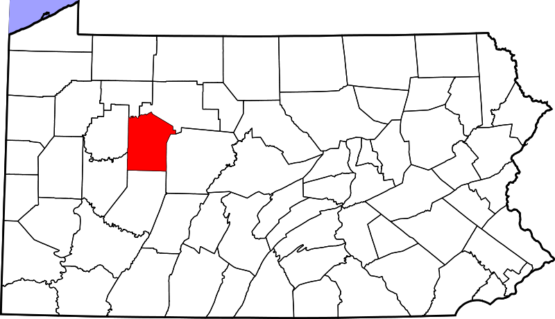
English: This is a locator map showing Jefferson County in Pennsylvania. For more information, see Commons:United States county locator maps. |
| Datum | |
| Fons |
Opus proprium: English: The maps use data from nationalatlas.gov, specifically countyp020.tar.gz on the Raw Data Download page. The maps also use state outline data from statesp020.tar.gz. The Florida maps use hydrogm020.tar.gz to display Lake Okeechobee. |
| Auctor | David Benbennick |
| SVG genesis |
Potestas usoris
| I, the copyright holder of this work, release this work into the public domain. This applies worldwide. In some countries this may not be legally possible; if so: I grant anyone the right to use this work for any purpose, without any conditions, unless such conditions are required by law. |
Historia fasciculi
Presso die vel tempore fasciculum videbis, sicut tunc temporis apparuit.
| Dies/Tempus | Minutio | Dimensiones | Usor | Sententia | |
|---|---|---|---|---|---|
| recentissima | 16:21, 12 Februarii 2006 | | 4 950 × 2 846 (106 chiliocteti) | David Benbennick | {{subst:User:Dbenbenn/clm|county=Jefferson County|state=Pennsylvania|type=county}} |
Nexus ad fasciculum
Ad hunc fasciculum nectit:
Usus fasciculi per inceptus Vicimediorum
Quae incepta Vici fasciculo utuntur:
- Usus in ar.wikipedia.org
- Usus in bg.wikipedia.org
- Usus in bpy.wikipedia.org
- Usus in cdo.wikipedia.org
- Usus in ceb.wikipedia.org
- Usus in cy.wikipedia.org
- Usus in de.wikipedia.org
- Usus in en.wikipedia.org
- List of counties in Pennsylvania
- Jefferson County, Pennsylvania
- Barnett Township, Jefferson County, Pennsylvania
- Beaver Township, Jefferson County, Pennsylvania
- Bell Township, Jefferson County, Pennsylvania
- Big Run, Jefferson County, Pennsylvania
- Brockway, Pennsylvania
- Brookville, Pennsylvania
- Clover Township, Jefferson County, Pennsylvania
- Corsica, Pennsylvania
- Eldred Township, Jefferson County, Pennsylvania
- Gaskill Township, Jefferson County, Pennsylvania
- Heath Township, Jefferson County, Pennsylvania
- Henderson Township, Jefferson County, Pennsylvania
- Knox Township, Jefferson County, Pennsylvania
- McCalmont Township, Pennsylvania
- Oliver Township, Jefferson County, Pennsylvania
- Perry Township, Jefferson County, Pennsylvania
- Pine Creek Township, Jefferson County, Pennsylvania
- Polk Township, Jefferson County, Pennsylvania
- Porter Township, Jefferson County, Pennsylvania
- Punxsutawney, Pennsylvania
- Reynoldsville, Pennsylvania
- Ringgold Township, Pennsylvania
- Rose Township, Jefferson County, Pennsylvania
- Snyder Township, Jefferson County, Pennsylvania
- Summerville, Pennsylvania
- Sykesville, Pennsylvania
- Timblin, Pennsylvania
- Union Township, Jefferson County, Pennsylvania
- Warsaw Township, Pennsylvania
- Washington Township, Jefferson County, Pennsylvania
- Winslow Township, Pennsylvania
- Worthville, Pennsylvania
- Young Township, Jefferson County, Pennsylvania
- Falls Creek, Pennsylvania
- Sprankle Mills, Pennsylvania
- Template:Jefferson County, Pennsylvania
- User:Ruhrfisch/Frog
View more global usage of this file.