
Fasciculus:Map of Michigan highlighting Iron County.svg

Size of this PNG preview of this SVG file: 512 × 599 elementa imaginalia. Aliae mensurae: 205 × 240 elementa imaginalia | 410 × 480 elementa imaginalia | 656 × 768 elementa imaginalia | 874 × 1 024 elementa imaginalia | 1 749 × 2 048 elementa imaginalia | 6 256 × 7 325 elementa imaginalia.
Sua resolutio (fasciculus SVG, nominale 6 256 × 7 325 elementa imaginalia, magnitudo fasciculi: 205 chiliocteti)
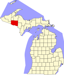
David Benbennick made this map. For more information, see Commons:United States county locator maps.
| I, the copyright holder of this work, release this work into the public domain. This applies worldwide. In some countries this may not be legally possible; if so: I grant anyone the right to use this work for any purpose, without any conditions, unless such conditions are required by law. |
Historia fasciculi
Presso die vel tempore fasciculum videbis, sicut tunc temporis apparuit.
| Dies/Tempus | Minutio | Dimensiones | Usor | Sententia | |
|---|---|---|---|---|---|
| recentissima | 12:55, 12 Februarii 2006 | | 6 256 × 7 325 (205 chiliocteti) | David Benbennick | {{subst:User:Dbenbenn/clm|county=Iron County|state=Michigan|type=county}} |
Nexus ad fasciculum
Ad hunc fasciculum nectit:
Usus fasciculi per inceptus Vicimediorum
Quae incepta Vici fasciculo utuntur:
- Usus in ar.wikipedia.org
- Usus in bg.wikipedia.org
- Usus in bpy.wikipedia.org
- Usus in cdo.wikipedia.org
- Usus in ceb.wikipedia.org
- Usus in cs.wikipedia.org
- Usus in cy.wikipedia.org
- Usus in de.wikipedia.org
- Usus in en.wikipedia.org
- List of counties in Michigan
- Iron County, Michigan
- Alpha, Michigan
- Bates Township, Michigan
- Caspian, Michigan
- Crystal Falls, Michigan
- Crystal Falls Township, Michigan
- Gaastra, Michigan
- Hematite Township, Michigan
- Iron River, Michigan
- Iron River Township, Michigan
- Mansfield Township, Michigan
- Mastodon Township, Michigan
- Mineral Hills, Michigan
- Stambaugh, Michigan
- Stambaugh Township, Michigan
- Amasa, Michigan
- Deer River (Michigan)
- Brule River
View more global usage of this file.