
Fasciculus:Herefordshire UK location map.svg

Size of this PNG preview of this SVG file: 473 × 599 elementa imaginalia. Aliae mensurae: 189 × 240 elementa imaginalia | 379 × 480 elementa imaginalia | 606 × 768 elementa imaginalia | 808 × 1 024 elementa imaginalia | 1 616 × 2 048 elementa imaginalia | 999 × 1 266 elementa imaginalia.
Sua resolutio (fasciculus SVG, nominale 999 × 1 266 elementa imaginalia, magnitudo fasciculi: 1.55 megaocteti)
| Descriptio |
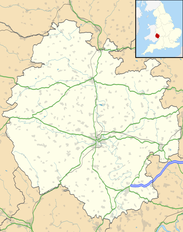
Map of Herefordshire, UK with the following information shown:
Equirectangular map projection on WGS 84 datum, with N/S stretched 160% Geographic limits:
|
| Datum | |
| Fons |
|
| Auctor | Nilfanion, created using Ordnance Survey data |
| Permissio (Reusing this file) |
This file is licensed under the Creative Commons Attribution-Share Alike 3.0 Unported license. Attributio: Contains Ordnance Survey data © Crown copyright and database right
|
| Other versions | File:Herefordshire UK district map (blank).svg - Blank map |
.svg)
Historia fasciculi
Presso die vel tempore fasciculum videbis, sicut tunc temporis apparuit.
| Dies/Tempus | Minutio | Dimensiones | Usor | Sententia | |
|---|---|---|---|---|---|
| recentissima | 18:55, 26 Septembris 2010 | | 999 × 1 266 (1.55 megaocteti) | Nilfanion | {{Information |Description=Map of Herefordshire, UK with the following information shown: *Administrative borders *Coastline, lakes and rivers *Roads and railways *Urban areas Equirectangular map projection on WGS 84 datum, with N/S s |
Nexus ad fasciculum
Ad hunc fasciculum nectunt:
Usus fasciculi per inceptus Vicimediorum
Quae incepta Vici fasciculo utuntur:
- Usus in ar.wikipedia.org
- Usus in az.wikipedia.org
- Usus in bg.wikipedia.org
- Usus in ceb.wikipedia.org
- Usus in cy.wikipedia.org
- Usus in en.wikipedia.org
- Hereford
- Kilpeck
- Eye, Herefordshire
- Symonds Yat
- Bacton, Herefordshire
- Leominster
- Kington, Herefordshire
- Ledbury
- Ross-on-Wye
- Bromyard
- Edvin Loach
- Weston under Penyard
- Pembridge
- Adforton
- Whitchurch, Herefordshire
- Welsh Bicknor
- Much Marcle
- Combe Moor
- Much Dewchurch
- Credenhill
- Welsh Newton
- Thornbury, Herefordshire
- Leintwardine
- List of places in Herefordshire
- Colwall
- Abbey Dore
- Weston Beggard
- Moreton on Lugg
- Peterchurch
- Cusop
- Weobley
- Llanwarne
- Pontrilas
- Yazor
- Eardisley
- Walford, Ross-on-Wye
- Little Hereford
- Preston on Wye
- Allensmore
- Hope under Dinmore
- Almeley
- Ashperton
- Aston Ingham
- Avenbury
View more global usage of this file.