
Fasciculus:Buckinghamshire UK locator map 2010.svg

Size of this PNG preview of this SVG file: 494 × 600 elementa imaginalia. Aliae mensurae: 198 × 240 elementa imaginalia | 395 × 480 elementa imaginalia | 633 × 768 elementa imaginalia | 843 × 1 024 elementa imaginalia | 1 687 × 2 048 elementa imaginalia | 1 108 × 1 345 elementa imaginalia.
Sua resolutio (fasciculus SVG, nominale 1 108 × 1 345 elementa imaginalia, magnitudo fasciculi: 302 chiliocteti)
Summarium
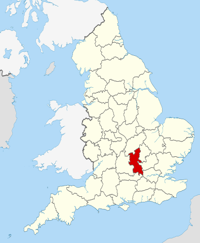
| Descriptio | Location of the ceremonial county of Buckinghamshire within England. |
| Datum | |
| Fons |
National Geospatial-Intelligence Agency
|
| Auctor | Nilfanion |
Potestas usoris
I, the copyright holder of this work, hereby publish it under the following licenses:
This file is licensed under the Creative Commons Attribution-Share Alike 3.0 Unported license.
- Tibi licet:
- communicare – copiare, distribuere et committere hoc opus
- to remix – to adapt the work
- His condicionibus:
- attributio – You must give appropriate credit, provide a link to the license, and indicate if changes were made. You may do so in any reasonable manner, but not in any way that suggests the licensor endorses you or your use.
- aequa parte – If you remix, transform, or build upon the material, you must distribute your contributions under the same or compatible license as the original.

|
Licet hoc documentum exscribere vel distribuere vel demutare sub GNU Liberarum Litterarum Licentiae conditionibus in editione 1.2 aut in ulla editione recentiori a Fundatione Liberarum Programmationis Partium publicata; praeterquam Sectiones Immutabiles et Verba Involucra Adversa et Aversa. Licentiae exemplar praesto est in sectione intitulata GNU Free Documentation License. |
Tibi typum permissionis ligere licet.

|
This is one of the images forming part of the Valued image set: Locator maps of the Ceremonial counties of England on Wikimedia Commons. The image set has been assessed under the valued image set criteria and is considered the most valued set on Commons within the scope:
Locator maps of the Ceremonial counties of England
You can see its nomination at Commons:Valued image candidates/Locator maps of English ceremonial counties. |
Historia fasciculi
Presso die vel tempore fasciculum videbis, sicut tunc temporis apparuit.
| Dies/Tempus | Minutio | Dimensiones | Usor | Sententia | |
|---|---|---|---|---|---|
| recentissima | 22:30, 23 Novembris 2010 | | 1 108 × 1 345 (302 chiliocteti) | Nilfanion | == Summary == {{Information |Description=Location of the ceremonial county of Buckinghamshire within England. |Source=Ordnance Survey [https://www.ordnancesurvey.co.uk/opendatadownload/products.html OpenData]: * |
Nexus ad fasciculum
Ad hunc fasciculum nectit:
Usus fasciculi per inceptus Vicimediorum
Quae incepta Vici fasciculo utuntur:
- Usus in af.wikipedia.org
- Usus in an.wikipedia.org
- Usus in arz.wikipedia.org
- Usus in ast.wikipedia.org
- Usus in be-tarask.wikipedia.org
- Usus in be.wikipedia.org
- Usus in bg.wikipedia.org
- Usus in ca.wikipedia.org
- Usus in ceb.wikipedia.org
- Usus in cs.wikipedia.org
- Usus in cy.wikipedia.org
- Usus in dag.wikipedia.org
- Usus in da.wikipedia.org
- Usus in el.wikipedia.org
- Usus in en.wikipedia.org
- Buckinghamshire
- New Zealand, Buckinghamshire
- Broughton Crossing
- Addington, Buckinghamshire
- Owlswick
- Tylers Green
- Verney Junction
- Burcott, Bierton
- Burcott, Wing
- Aston Sandford
- Marsh, Buckinghamshire
- Akeley, Buckinghamshire
- Askett
- Astwood, Buckinghamshire
- Ballinger, Buckinghamshire
- Bledlow Ridge
- Green Hailey
- Booker, Buckinghamshire
- Botley, Buckinghamshire
- Botolph Claydon
- Boveney
- Butlers Cross
- Middleton, Milton Keynes
- Cadmore
- Chalkshire
- Charndon
- Chilton, Buckinghamshire
- Clifton Reynes
- Cold Brayfield
- Coldmoorholme
- Coleshill, Buckinghamshire
- Cooks Wharf
View more global usage of this file.